Naremburn, New South Wales
| Naremburn Sydney, New South Wales | |||||||||||||||
|---|---|---|---|---|---|---|---|---|---|---|---|---|---|---|---|
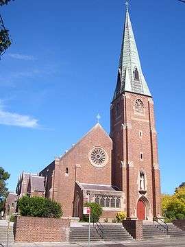 St Leonards Catholic Church, Naremburn | |||||||||||||||
| Population | 5,884 (2016 census)[1] | ||||||||||||||
| • Density | 3,441/km2 (8,912/sq mi) | ||||||||||||||
| Established | 1853 | ||||||||||||||
| Postcode(s) | 2065 | ||||||||||||||
| Area | 1.71 km2 (0.7 sq mi) | ||||||||||||||
| Location | 6 km (4 mi) north of Sydney CBD | ||||||||||||||
| LGA(s) | City of Willoughby | ||||||||||||||
| State electorate(s) | Willoughby | ||||||||||||||
| Federal Division(s) | North Sydney | ||||||||||||||
| |||||||||||||||
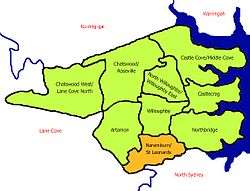
Naremburn is a suburb on the lower North Shore of Sydney, New South Wales, Australia. Naremburn is located 6 kilometres north of the Sydney central business district, in the local government area of the City of Willoughby.
History
The suburb name dates to the 1800s but its origin cannot be verified. Naremburn was originally known as Central Township. The earliest land grants in the area were granted to Humphrey Evans and Peter Dargan in 1794.[2]
Naremburn Post Office opened on 20 March 1882 and closed in 1996.[3]
Population
In the 2016 Census, there were 5,884 people in Naremburn. 61.4% of people were born in Australia. The next most common countries of birth were England 5.4%, China 2.9% and New Zealand 2.6%. 72.4% of people only spoke English at home. Other languages spoken at home included Mandarin 3.3%, Cantonese 2.7% and Japanese 1.9%. The most common responses for religion were No Religion 36.9%, Catholic 23.9% and Anglican 14.0%.[1]
Commercial area and transport
Naremburn has a small shopping strip on Willoughby Road about ten minutes' walk from Crows Nest.
The Warringah Freeway to the city runs through the suburb. The closest railway station is St Leonards railway station on the North Shore, Northern & Western Line of the Sydney Trains network.
Churches
- St Leonards Catholic Church, built in 1913[4]
- St Cuthberts Anglican Church (Naremburn Cammeray Anglican Church)
Former primary schools
Until the 1990s, there were two primary schools operating — St Leonard’s Catholic Primary School, and, Naremburn Public School — both on Willoughby Road. The Catholic school shared the same site as the adjacent Catholic church, and, the public school was located opposite on Willoughby Road. Changing demographics and corresponding lack of demand led to both schools being closed within five years of each other. The former Catholic school is now a creative arts learning centre. The former public school is now a housing development.
Gallery
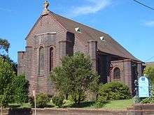 St Cuthberts Anglican Church
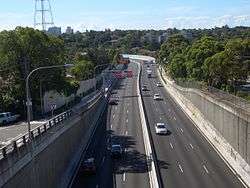 Warringah Freeway
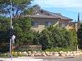 Willoughby Road
References
- 1 2 Australian Bureau of Statistics (27 June 2017). "Naremburn (State Suburb)". 2016 Census QuickStats. Retrieved 13 March 2018.

- ↑ The Book of Sydney Suburbs, Compiled by Frances Pollon, Angus & Robertson Publishers, 1990, Published in Australia ISBN 0-207-14495-8, page 183
- ↑ Premier Postal History. "Post Office List". Premier Postal Auctions. Retrieved 16 June 2012.
- ↑ http://www.cathchurch.net/nsw/parish/Naremburn.htm
External links
| Wikimedia Commons has media related to Naremburn, New South Wales. |
- Naremburn/St Leonards - community profile
- Clare Evans - Willoughby City Library (2008). "Naremburn". Dictionary of Sydney. Retrieved 28 September 2015. [CC-By-SA]
Coordinates: 33°49′09″S 151°11′59″E / 33.81925°S 151.19971°E