Naraingarh
| Naraingarh Naraingarh | |
|---|---|
| Naraingarh | |
 | |
 Naraingarh Location in Haryana, India  Naraingarh Naraingarh (India) | |
| Coordinates: 30°28′35″N 77°07′40″E / 30.47639°N 77.12778°ECoordinates: 30°28′35″N 77°07′40″E / 30.47639°N 77.12778°E | |
| Country |
|
| State | Haryana |
| District | Ambala |
| Founded by | King Of Sirmaur |
| Named for | Vishnu (GOD) |
| Government | |
| • Body | Municipal Corporation |
| Area | |
| • Total | 481 km2 (186 sq mi) |
| Population (2011) | |
| • Total | 30,968 |
| • Density | 64/km2 (170/sq mi) |
| Demonym(s) | Naraiangarhiye |
| Languages | |
| • Official | Hindi |
| • Spoken | Pwadhi |
| Time zone | UTC+5:30 (IST) |
| PIN | 134203 |
| Telephone code | 91 1734 |
| ISO 3166 code | IN-HR |
| Vehicle registration | HR-04 |
| Sex ratio | 890 |
| Website |
haryana |
Naraingarh (also: Narayangarh) is a city, municipal committee and assembly constituency in the Ambala district of the Indian state of Haryana, located on the border with the Indian state of Himachal Pradesh. Due to its geographical location, the Naraingarh plays an important role in local tourism, being located 52 km (32 miles) of Chandigarh, the state capital, 144 km (89 miles) of Shimla, and 230 km (142 miles) of New Delhi .
Etymology
The name Naraingarh (Narayangarh) is a portmanteau of Narayana and Garh. Narayana refers to Hindu god Narayana, is the supreme absolute being in Hinduism and is considered as the supreme deity in Vaishnavism and Garh means home.
Demographics
Population
Naraingarh is a Tehsil located in Ambala district of Haryana. It is one of 3 Tehsils of Ambala district. There are 170 villages and 2 towns in Naraingarh Tehsil.
As per the Census India 2011, Naraingarh Tehsil has 42,818 households, population of 2,28,747 of which 1,21,055 are males and 1,07,692 are females. The population of children between age 0-6 is 27,306 which is 11.94% of total population.
The sex-ratio of Naraingarh Tehsil is around 890 compared to 879 which is average of Haryana state. The literacy rate of Naraingarh Tehsil is 68.43% out of which 73.71% males are literate and 62.48% females are literate. The total area of Naraingarh is 481.06 sq.km with a population density of 476 per sq.km.
Out of total population, 86.46% of the population lives in rural area and 13.54% lives in urban areas. There are 28.58% Scheduled Caste (SC) and 0 Scheduled Tribe (ST) of total population in Naraingarh Tehsil.
Religion
Hinduism is the prominent religion of Narayangarh followed by 89.36% of the population. Sikhism is the second most popular religion in the city followed 8.31% of the people. In Naraingarh Islam is followed by 1.82%. Minorities are Christians 0.21%, Jains 0.18%, those that didn't state a religion are 0.12%, and others are 0.0%.
Languages
Hindi is the sole official language of Naraingarh. The majority of the population speaks Pwadhi (85%) while Hindi is spoken by 10%.[2] Government schools use English, Hindi textbooks.
Education
Naraingarh has a large number of schools and colleges. Notable colleges include:- \
- Government Senior Secondary School (boys), Naraingarh
- Government Senior Secondary School (girls), Naraingarh
- D.A.V Senior Secondary School, Naraingarh
- Blue Bells School, Naraingarh
- Sun Rise Public School
- Mind Tree Public School
- Aarya Senior Secondary School
- N.R.M. High School
- S.M.B Geeta School
- Government College, Naraingarh
- ICL Group of Colleges, Shahzadpur
Transport
Naraingarh is connected by road to all of the other major cities of north India including Delhi, Dehradun, Chandigarh, Jalandhar, Paonta Sahib and Shimla.
NH 72 passes through Naraingarh and connects it to Ambala , Shahzadpur, Nahan, Paonta Sahib and Haridwar. NH 73 passes through Naraingarh and connects it to Punchkula, Shahzadpur, Saha,Yamunanagar, SaharanPur and Haridwar. State Highway 1 connects it to state capital Chandigarh and Raipur Rani.
Villages in Naraingarh Tehsil
There are 170 villages in Naraingarh Tehsil.
- Ahmadpur
- Akbarpur
- Ambli
- Andheri
- Azampur
- Badhauli
- Badi Kohri
- Bakarpur
- Baktuha
- Ballopur
- Banaundi
- Bapauli
- Bara Gaon
- Bara Korwa
- Baragarh
- Barheri
- BadiBarheri
- ChhotiBasi
- BassiBari
- Rasaur
- Baroli
- Barsu Majra
- Batora
- Behloli
- Ber Kheri
- Berpura
- Bharanpur
- Bharog
- Bheron
- Bibipur
- Bichpari
- Bilaspur
- Boron
- Brahman Majra
- Budha Khera
- Bukhari
- Burj Shahid
- Chand Sauli
- Chautan
- Chechi Majra
- Chhajal Majra
- Chhajju Majra
- Chhotagarh
- Chhoti Bassi
- Chhoti Kohri
- Chhoti Rasaur
- Danora
- Dehar
- Dehri
- Dera
- Dhamauli Bichli
- Dhamauli Majri
- Dhamauli Uparli
- Dhanana
- Dudhli
- Fatehpur
- Ferozepur
- Ferozepur Kathka
- Gadauli
- Ganauli
- Ganeshpur
- Gharauli
- Hamidpur
- Handi Khera
- Harbon
- Hassanpur
- Husaini
- Jagatpur
- Jangoo Majra
- Jangu Majra
- Jeoli
- Jhar Sahala
- Kakar Majra
- Kalal Majra
- Kalal Majri
- Kalyana
- Kanjala
- Karasan
- Kathe Majra
- Khanpur Labana
- Khanpur Rajputan
- Khera Jattan
- Kherki Manakpur
- Khirki Jatan
- Khurd
- Kohra Bhura
- Korwa Khurd
- Kullarpur
- Kurali (बंभूल सिंह की)
- Laha
- Lakhnaura
- Lalpur
- Lautan
- Magharpura
- Majra
- Manakpur
- Manglor
- Mawa Kheri
- Mianpur
- Milk
- Mirpur
- Mirzapur Kath
- Mugal Majra
- Muna Majra
- Mukand Pur
- Nabipur
- Nagal
- Nagauli
- Nagla
- Nakhrauli
- Nanduwali
- Nanehra
- Nangawan
- Naraingarh
- Nasrauli
- NauGawan
- Nek Nawan
- Okhal
- Panjauri
- Panjeton
- Panjlasa
- Parail
- Patrehri
- Patwi
- Pulewala
- Rachheri
- Raiwali
- Rajawali
- Rajpura
- Raju Majra
- Ramgarh
- Rampur
- Rao Majra
- Rasidpur
- Rataur
- Rerh Viran
- Sadaqpur
- Salola
- Sam Bhalva
- Sangrani
- Santokhi
- Shahpur
- Shahzadpur
- Shakarpura
- Sherpur
- Sian Majra
- Sontli
- Surgal
- Tandwal
- Tanka Majra
- Tapparian Rulduki
- Tapri Shahid
- Tepla
- Toka
- Ujjhal Majri
- Wasalpur
Villages by Population
Following is a list of villages by population in Naraingarh Tehsil according to 2011 Census of India
| No | Village | Total Population |
|---|---|---|
| 1 | Dera | 7,872 |
| 2 | Shahzadpur | 7,278 |
| 3 | Pathreri | 5,645 |
| 4 | Gadhauli | 4,949 |
| 5 | Badhauli | 4,442 |
| 6 | Jatwar | 4,230 |
| 7 | Kurali(B.S) | 4,222 |
| 8 | Dhanana | 4,052 |
| 9 | Panjlasa | 3,203 |
| 10 | Korwa Khurd | 2,957 |
Geography and ecology
Location
Naraingarh is located near the foothills of the Sivalik range of the Himalayas in northwest India. It covers an area of approximately 481 km2.[3] It shares its borders with the states of Himachal Pradesh. The exact cartographic co-ordinates of Narayangarh are 30°28′N 77°08′E / 30.47°N 77.13°E.It has an average elevation of 325 metres (1065 ft).
The city, lying in the northern plains, has vast fertile and flat land. It has portions of Bhabar in the north east and Terai in rest of the area.
Climate
| Naraingarh | ||||||||||||||||||||||||||||||||||||||||||||||||||||||||||||
|---|---|---|---|---|---|---|---|---|---|---|---|---|---|---|---|---|---|---|---|---|---|---|---|---|---|---|---|---|---|---|---|---|---|---|---|---|---|---|---|---|---|---|---|---|---|---|---|---|---|---|---|---|---|---|---|---|---|---|---|---|
| Climate chart (explanation) | ||||||||||||||||||||||||||||||||||||||||||||||||||||||||||||
| ||||||||||||||||||||||||||||||||||||||||||||||||||||||||||||
| ||||||||||||||||||||||||||||||||||||||||||||||||||||||||||||
Naraingarh has a humid subtropical climate (Köppen: Cwa) characterised by a seasonal rhythm: very hot summers, mild winters, unreliable rainfall and great variation in temperature (−1 °C to 46 °C OR 30.2 °F to 114 °F). The city also receives occasional winter rains from the Western Disturbance originating over the Mediterranean Sea.
The western disturbances usually brings rain predominantly from mid-December till end of April which can be heavier sometimes with strong winds and hails if the weather turns colder (during March–April months) which usually proves disastrous to the crops. Cold winds usually tend to come from the north near Shimla, capital of Himachal Pradesh and from the state of Jammu and Kashmir, both of which receive their share of snowfall during wintertime.
The city experiences the following seasons and the respective average temperatures:
- Spring: The climate remains the most enjoyable part of the year during the spring season (from February-end to early-April). Temperatures vary between (max) 13 °C to 20 °C and (min) 5 °C to 12 °C.
- Autumn: In autumn (from September-end to mid November.), the temperature may rise to a maximum of 30 °C. Temperatures usually remain between 10° to 22° in autumn. The minimum temperature is around 6 °C.
- Summer: The temperature in summer (from Mid-April to June-end) may rise to 44 °C. The temperatures might sometime rise to 44 °C in mid-June. Temperatures generally vary between 40 and 42 °C.
- Monsoon: During monsoon (from early-July to mid-September), Naraingarh receives moderate to heavy rainfall and sometimes heavy to very heavy rainfall (generally during the month of August or September). Usually, the rain bearing monsoon winds blow from south-west/south-east. Mostly, the city receives heavy rain from south (which is mainly a persistent rain) but it generally receives most of its rain during monsoon either from North-west or North-east. Maximum amount of rain received by the city of Naraingarh during monsoon season is 195.5 mm in a single day.
- Winter: Winters (November-end to February-end) are mild but it can sometimes get quite chilly in Naraingarh. Average temperatures in the winter remain at (max) 5 °C to 14 °C and (min) -1 °C to 5 °C. Rain usually comes from the west during winters and it is usually a persistent rain for 2–3 days with sometimes hailstorms. The city witnessed bone-numbing chill as the maximum temperature on Monday, 7 January 2013 plunged to a 30-year low to settle at 6.1 degrees Celsius.
| Climate data for Naraingarh | |||||||||||||
|---|---|---|---|---|---|---|---|---|---|---|---|---|---|
| Month | Jan | Feb | Mar | Apr | May | Jun | Jul | Aug | Sep | Oct | Nov | Dec | Year |
| Record high °C (°F) | 27.7 (81.9) |
32.8 (91) |
37.8 (100) |
42.7 (108.9) |
44.6 (112.3) |
45.3 (113.5) |
42.0 (107.6) |
39.0 (102.2) |
37.5 (99.5) |
37.0 (98.6) |
34.0 (93.2) |
28.5 (83.3) |
45.6 (114.1) |
| Average high °C (°F) | 20.4 (68.7) |
23.1 (73.6) |
28.4 (83.1) |
34.5 (94.1) |
38.3 (100.9) |
38.6 (101.5) |
34.0 (93.2) |
32.7 (90.9) |
33.1 (91.6) |
31.8 (89.2) |
27.3 (81.1) |
22.1 (71.8) |
30.4 (86.7) |
| Average low °C (°F) | 6.1 (43) |
8.3 (46.9) |
13.4 (56.1) |
18.9 (66) |
23.1 (73.6) |
25.4 (77.7) |
23.9 (75) |
23.3 (73.9) |
21.8 (71.2) |
17.0 (62.6) |
10.5 (50.9) |
6.7 (44.1) |
16.5 (61.7) |
| Record low °C (°F) | 0.0 (32) |
0.0 (32) |
4.2 (39.6) |
7.8 (46) |
13.4 (56.1) |
14.8 (58.6) |
14.2 (57.6) |
17.2 (63) |
14.3 (57.7) |
9.4 (48.9) |
3.7 (38.7) |
0.0 (32) |
0.0 (32) |
| Average rainfall mm (inches) | 33.1 (1.303) |
38.9 (1.531) |
30.4 (1.197) |
8.5 (0.335) |
28.4 (1.118) |
145.2 (5.717) |
280.4 (11.039) |
307.5 (12.106) |
133.0 (5.236) |
21.9 (0.862) |
9.4 (0.37) |
21.9 (0.862) |
1,059.3 (41.705) |
| Average rainy days | 2.6 | 2.8 | 2.6 | 1.1 | 2.1 | 6.3 | 12.3 | 11.4 | 5.0 | 1.4 | 0.8 | 1.4 | 49.8 |
| Source: India Meteorological Department (record high and low up to 2010)[4][5] | |||||||||||||
Gallery
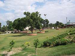
- Municipality Park
References
- ↑ "Ambala City Population Census 2011 - Haryana". www.census2011.co.in.
- 1 2 "Report of the Commissioner for linguistic minorities: 50th report (July 2012 to June 2013)" (PDF). Commissioner for Linguistic Minorities, Ministry of Minority Affairs, Government of India. Retrieved 2 January 2017.
- ↑ "About Chandigarh". Government of Chandigarh. Retrieved 12 March 2015.
- ↑
"Naraingarh Climatological Table Period: 1971–2000". India Meteorological Department. Missing or empty
|url=(help);|access-date=requires|url=(help) - ↑ "Ever recorded Maximum and minimum temperatures up to 2010" (PDF). India Meteorological Department. Archived from the original (PDF) on 21 May 2013. Retrieved 25 March 2015.
- ↑ "Census of India 2001: Data from the 2001 Census, including cities, villages and towns (Provisional)". Census Commission of India. Archived from the original on 2004-06-16. Retrieved 2008-11-01.
- ↑ "Census of India 2001: Data from the 2001 Census, including cities, villages and towns (Provisional)". Census Commission of India. Archived from the original on 2004-06-16. Retrieved 2008-11-01.
Ambala district topics | ||
|---|---|---|
| Cities and towns |  | |
| Transport | ||
| Lok Sabha constituencies | ||