Nanto, Toyama
| Nanto 南砺市 | |||
|---|---|---|---|
| City | |||
 Nanto City Hall | |||
| |||
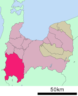 Location of Nanto in Toyama Prefecture | |||
 Nanto | |||
| Coordinates: 36°35′16″N 136°55′9.8″E / 36.58778°N 136.919389°ECoordinates: 36°35′16″N 136°55′9.8″E / 36.58778°N 136.919389°E | |||
| Country | Japan | ||
| Region | Chūbu (Kōshin'etsu) | ||
| Prefecture | Toyama | ||
| Area | |||
| • Total | 668.64 km2 (258.16 sq mi) | ||
| Population (February 28, 2018) | |||
| • Total | 51,669 | ||
| • Density | 77/km2 (200/sq mi) | ||
| Time zone | UTC+9 (Japan Standard Time) | ||
| Symbols | |||
| Phone number | 0763-23-2003 | ||
| Address | 4880 Naeshima, Nanto-shi, Toyama-ken 939-1596 | ||
| Website |
www | ||


Nanto (南砺市 Nanto-shi) is a city in Toyama Prefecture, Japan.
As of 28 February 2018, the city had an estimated population of 51,669 in 17,761 households [1]and a population density of 75.8 persons per km². Its total area is 668.64 square kilometres (258.16 sq mi).[2]
Geography
Nanto is located in the southwestern Toyama Prefecture, and is bordered by Ishikawa Prefecture to the west and Gifu Prefecture to the south. The northern part of the city is within the Tochi plains, and the southern portion of the city is mountainous. Much of the area is a dispersed settlement typical of this region of Japan. Nanto has a humid continental climate (Köppen Cfa) characterized by mild summers and cold winters with heavy snowfall. The average annual temperature in Nanto is 13.6 °C. The average annual rainfall is 2410 mm with September as the wettest month.The temperatures are highest on average in August, at around 26.3 °C, and lowest in January, at around 2.0 °C.[3]
Surrounding municipalities
Demographics
Per Japanese census data,[4] the population of Nanto has declined over the past 40 years.
| Census Year | Population |
|---|---|
| 1970 | 68,979 |
| 1980 | 66,844 |
| 1990 | 65,113 |
| 2000 | 60,182 |
| 2010 | 54,724 |
History
The area of present-day Nanto was part of ancient Etchū Province.
The modern city of Nanto was established on November 1, 2004, from the merger of the towns of Fukuno, Inami and Jōhana, the villages of Inokuchi, Kamitaira, Taira and Toga (all from Higashitonami District), and the town of Fukumitsu (from Nishitonami District).[2]
Government
Nanto has a mayor-council form of government with a directly elected mayor and a unicameral city legislature of 20 members.
Education
Nanto has nine public elementary schools and eight public junior high schools operated by the town government, and three public high schools operated by the Toyama Prefectural Board of Education.<ref> official home page (in Japanese)</ref>
Transportation
Railway
.svg.png)
- Takagi - Fukuno - Higashi-Ishiguro - Fukumitsu - Etchū-Yamada - Jōhana
Highway
International relations


.svg.png)


In media
The animation company Progressive Animation Works is headquartered in the city.
See also
References
- ↑ home page official statuistics(in Japanese)
- 1 2 "A Survey of Nanto City". Nanto City. Retrieved 16 July 2017.
- ↑ Nanto climate data
- ↑ Nanto population statistics
- 1 2 3 "International Exchange". List of Affiliation Partners within Prefectures. Council of Local Authorities for International Relations (CLAIR). Retrieved 21 November 2015.
- ↑ "US-Japan Sister Cities by State". Asia Matters for America. Honolulu, HI: East-West Center. Retrieved 20 November 2015.
External links
| Wikimedia Commons has media related to Nanto, Toyama. |
- Official website (in Japanese)