Nankoku, Kōchi
| Nankoku 南国市 | |||
|---|---|---|---|
| City | |||
 View of Tosa Bay and Pacific Ocean from Zenjibu Temple | |||
| |||
 Location of Nankoku in Kōchi Prefecture | |||
 Nankoku Location in Japan | |||
| Coordinates: 33°35′N 133°38′E / 33.583°N 133.633°ECoordinates: 33°35′N 133°38′E / 33.583°N 133.633°E | |||
| Country | Japan | ||
| Region | Shikoku | ||
| Prefecture | Kōchi Prefecture | ||
| Government | |||
| • Mayor | Toshihito Hashizume | ||
| Area | |||
| • Total | 125.35 km2 (48.40 sq mi) | ||
| Population (March 31, 2017) | |||
| • Total | 47,776 | ||
| • Density | 380/km2 (990/sq mi) | ||
| Symbols | |||
| • Tree | Yamamomo | ||
| • Flower | Tachibana (Citrus tachibana) | ||
| • Bird | Onagadori (Long tail chicken) | ||
| Time zone | UTC+9 (JST) | ||
| City hall address |
2301 Ōsone Kō, Nankoku-shi, Kōchi-ken 783-8501 | ||
| Website |
www | ||


Nankoku (南国市 Nankoku-shi) is a city located in Kōchi Prefecture, Japan. Strong in the fishing industry and the market industry, Nankoku-shi supplies most of Kochi's agricultural needs, because of the amount of fields and plantations. Kōchi Ryōma Airport, which serves the city of Kochi, is located southeast of Nankoku-shi. The city was formally named on October 1, 1959.
As of March 31, 2017, the city has an estimated population of 47‚776, with 21‚952 households[1] and a population density of 380 persons per km². The total area is 125.35 km².
Transport

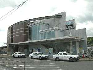
Downtown of Nankoku

Airport
Railway
Tourism
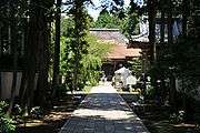
Tosa Kokubunji
- Kochi Prefectural Museum of History
- OKō Castle
- Tosa Kokubunji
- Zenjibuji
Notable people from Nankoku
- Hiroshi Miyama, enka singer
- Yuji Okabayashi, professional wrestler
References
- ↑ "Official website of Nankoku City" (in Japanese). Japan: Nankoku City. Retrieved 1 May 2017.
External links
| Wikimedia Commons has media related to Nankoku, Kochi. |
- Nankoku City official website (in Japanese)
- Kitaro Shikoku Peace Bell Project


| Core city | ||
|---|---|---|
| Cities | ||
| Districts | ||
This article is issued from
Wikipedia.
The text is licensed under Creative Commons - Attribution - Sharealike.
Additional terms may apply for the media files.