Tsuno, Kōchi
| Tsuno 津野町 | |||
|---|---|---|---|
| Town | |||
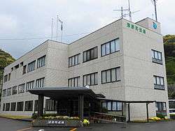 Tsuno town hall | |||
| |||
 Location of Tsuno in Kōchi Prefecture | |||
 Tsuno Location in Japan | |||
| Coordinates: 33°27′N 133°12′E / 33.450°N 133.200°ECoordinates: 33°27′N 133°12′E / 33.450°N 133.200°E | |||
| Country | Japan | ||
| Region | Shikoku | ||
| Prefecture | Kōchi Prefecture | ||
| District | Takaoka | ||
| Area | |||
| • Total | 197.85 km2 (76.39 sq mi) | ||
| Population (October 1, 2016) | |||
| • Total | 5,680 | ||
| • Density | 29/km2 (74/sq mi) | ||
| Time zone | UTC+9 (JST) | ||
| Website |
www | ||


Tsuno (津野町 Tsuno-chō) is a town located in Takaoka District, Kōchi Prefecture, Japan.
It was formed on February 1, 2005 from the merger of the villages of Hayama and Higashitsuno, both from Takaoka District.
As of October 2016, the town has an estimated population of 5,680 and a density of 29 persons per km². The total area is 197.85 km².[1]
References
- ↑ "Outline of Tsuno Town" (in Japanese). Japan: Tsuno Town. Retrieved 2 May 2017.
External links

- Tsuno official website (in Japanese)
This article is issued from
Wikipedia.
The text is licensed under Creative Commons - Attribution - Sharealike.
Additional terms may apply for the media files.