Nanceddan
Nanceddan
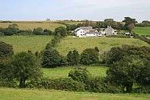
Nanceddan is a farm north of Ludgvan in west Cornwall, England.[1] [2]
See also
References
Cornwall Portal | |
| Unitary authorities | |
| Major settlements |
|
| Rivers | |
| Topics | |
This article is issued from
Wikipedia.
The text is licensed under Creative Commons - Attribution - Sharealike.
Additional terms may apply for the media files.