Nan'an District
| Nan'an 南岸区 | |
|---|---|
| District | |
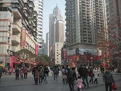 Nanping CBD pedestrian mall in Nan'an. | |
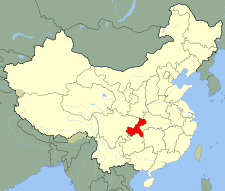
 Nan'an District in Chongqing | |
| Country | People's Republic of China |
| Municipality | Chongqing |
| Time zone | UTC+8 (China Standard) |
Nan'an District[1] (Chinese: 南岸区; pinyin: Nán'àn Qū; Jyutping: naam4ngon6 keoi1; literally: "the southern bank of Yangtze River"), is one of the six central districts of Chongqing municipality, China. It covers an area of 265 square kilometers, with 44 square km covered with forests and woods. It has an estimated population of 600,000 as of the year 2006.
Geography
The Yangtze River curves around the north and west border of Nan'an district for about 45 kilometers. The river separates Nan'an from its neighbouring districts such as Jiulongpo, Yuzhong, Jiangbei, and Yubei. The bridges crossing the Yangtze River are the primary passage for transportations to and from the other side of the river. Ferries are also available as a backup and they used to be the only connection to the central part of downtown Chongqing before the first bridge was built in the early 1980s. Nan'an shares the border on the south and east land area with Banan.
History
Nan'an district is one important part of the historical city Chongqing. It was first established in 1929 as an administrative region when the city underwent expansions. At that time, it covers the current Nan Ping (southern plain), Hai Tang Qi (Azalea Creek), Long Men Hao (Grand Water of Dragon Gate), and Dan Zi Shi (Pebble Stone). With series changes to its covering area and naming from the year 1929 through 1950, Nan'an got its current name in October 1955.
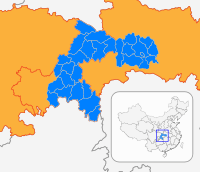
Administrative divisions
| Name | Chinese (S) | Hanyu Pinyin | Population (2010)[2] | Area (km2) |
|---|---|---|---|---|
| Tongyuanju Subdistrict | 铜元局街道 | Tóngyuánjú Jiēdào | 49,972 | 2.9 |
| Huayuan Road Subdistrict | 花园路街道 | Huāyuánlù Jiēdào | 98,320 | 4.4 |
| Nanping Subdistrict | 南坪街道 | Nánpíng Jiēdào | 113,193 | 3.6 |
| Haitangxi Subdistrict | 海棠溪街道 | Hǎitángxī Jiēdào | 110,310 | 4.1 |
| Longmenhao Subdistrict | 龙门浩街道 | Lóngménhào Jiēdào | 27,615 | 1.7 |
| Danzishi Subdistrict | 弹子石街道 | Dànzǐshí Jiēdào | 36,299 | 1 |
| Nanshan Subdistrict | 南山街道 | Nánshān Jiēdào | 56,888 | 33 |
| Nanping town | 南坪镇 | Nánpíng Zhèn | 97,081 | 16.7 |
| Tushan town | 涂山镇 | Túshān Zhèn | 53,146 | 7.1 |
| Jiguanshi town | 鸡冠石镇 | Jīguānshí Zhèn | 16,053 | 15.4 |
| Xiakou town | 峡口镇 | Xiákǒu Zhèn | 11,787 | 31.6 |
| Changshengqiao town | 长生桥镇 | Chángshēngqiáo Zhèn | 57,960 | 65.6 |
| Yinglong town | 迎龙镇 | Yínglóng Zhèn | 16,319 | 45.72 |
| Guangyang town | 广阳镇 | Guǎngyáng Zhèn | 14,627 | 37.1 |
Education
Nan'an district is the home of five colleges and over ten national or provincial research institutes including Chongqing University of Posts and Telecommunications, Chongqing Technology and Business University, Chongqing Jiaotong University, Chongqing Education College, Chongqing Pharmaceutical Research Institute, etc.
Tourist attractions
Nan'an is best known for its abundance of natural and historical tourist attractions. In particular, the Nanshan (南山, Southern Mountain) is located here. The Ciyun temple (慈云寺), Tushan temple (涂山寺), and Laojun Cave (老君洞) were built in as early as the Tang Dynasty. Nan Wen Quan (Southern Hot Spring) is a hot spring for relaxation. There are also rowing boats. Yikeshu (一棵树; "Single-Tree") sightseeing spot provides a panorama of Chongqing. There are also hiking trails. Foreigners' Street is an amusement park that includes the world's largest toilet, the Porcelain Palace.
Transport
Metro
Nan'an is currently served by one metro lines operated by Chongqing Rail Transit:
- Ertang, Liugongli, Wugongli, Sigongli, Nanping, Gongmao, Tongyuanju
References
- ↑ "Nan'an". Encyclopædia Britannica. Retrieved 19 September 2014.
- ↑ shi, Guo wu yuan ren kou pu cha ban gong; council, Guo jia tong ji ju ren kou he jiu ye tong ji si bian = Tabulation on the 2010 population census of the people's republic of China by township / compiled by Population census office under the state; population, Department of; statistics, employment statistics national bureau of (2012). Zhongguo 2010 nian ren kou pu cha fen xiang, zhen, jie dao zi liao (Di 1 ban. ed.). Beijing Shi: Zhongguo tong ji chu ban she. ISBN 978-7-5037-6660-2.