Nababeep
| Nababeep | |
|---|---|
 Nababeep  Nababeep Nababeep (South Africa)  Nababeep Nababeep (Africa) | |
| Coordinates: 29°53′31″S 17°46′59″E / 29.892°S 17.783°ECoordinates: 29°53′31″S 17°46′59″E / 29.892°S 17.783°E | |
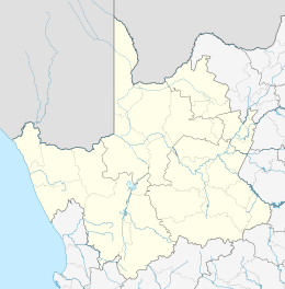
| Country | South Africa |
| Province | Northern Cape |
| District | Namakwa |
| Municipality | Nama Khoi |
| Area[1] | |
| • Total | 123.13 km2 (47.54 sq mi) |
| Population (2011)[1] | |
| • Total | 5,374 |
| • Density | 44/km2 (110/sq mi) |
| Racial makeup (2011)[1] | |
| • Black African | 3.9% |
| • Coloured | 91.2% |
| • Indian/Asian | 0.5% |
| • White | 4.2% |
| • Other | 0.2% |
| First languages (2011)[1] | |
| • Afrikaans | 96.2% |
| • Xhosa | 1.5% |
| • Other | 2.3% |
| Time zone | UTC+2 (SAST) |
| Postal code (street) | 8265 |
| PO box | 8265 |
Nababeep is a town in Namakwa District Municipality in the Northern Cape province of South Africa.
Old copper-mining town in Namaqualand, 19 km north-west of Springbok. Founded in 1860 by the Okiep Copper Company. The name is of Khoekhoen origin and means ‘rhinoceros place’.[2]
References
- 1 2 3 4 "Main Place Nababeep". Census 2011.
- ↑ "Dictionary of Southern African Place Names (Public Domain)". Human Science Research Council. p. 326.
Municipalities and communities of Namakwa District Municipality, Northern Cape | ||
|---|---|---|
District seat: Springbok | ||
| Hantam | .svg.png) | |
| Kamiesberg | ||
| Karoo Hoogland | ||
| Khâi-Ma | ||
| Nama Khoi | ||
| Richtersveld | ||
This article is issued from
Wikipedia.
The text is licensed under Creative Commons - Attribution - Sharealike.
Additional terms may apply for the media files.