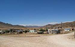
Eksteenfontein
| Eksteenfontein | |
|---|---|
 Eksteenfontein | |
 Eksteenfontein  Eksteenfontein Eksteenfontein (South Africa)  Eksteenfontein Eksteenfontein (Africa) | |
| Coordinates: 28°49′26″S 17°15′18″E / 28.824°S 17.255°ECoordinates: 28°49′26″S 17°15′18″E / 28.824°S 17.255°E | |
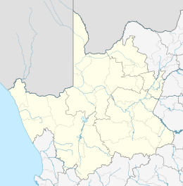
| Country | South Africa |
| Province | Northern Cape |
| District | Namakwa |
| Municipality | Richtersveld |
| Area[1] | |
| • Total | 0.73 km2 (0.28 sq mi) |
| Population (2011)[1] | |
| • Total | 531 |
| • Density | 730/km2 (1,900/sq mi) |
| Racial makeup (2011)[1] | |
| • Black African | 0.9% |
| • Coloured | 89.3% |
| • Other | 9.8% |
| First languages (2011)[1] | |
| • Afrikaans | 94.5% |
| • English | 1.3% |
| • Tswana | 1.1% |
| • Other | 3.0% |
| Time zone | UTC+2 (SAST) |
| PO box | 8284 |
Eksteenfontein is a town in Namakwa District Municipality in the Northern Cape province of South Africa, on the edge of the Richtersveld World Heritage Site.[2]
The locals are mostly of Baster ancestry, people of mixed blood who were forcibly removed from the white farming area near Pofadder in 1945.[2] The town was originally known as Stinkfontein (stinking spring), but was later renamed in honour of a Reverend Eksteen, the pastor who had helped the Baster in finding a new place to live.[2]
References
- 1 2 3 4 "Main Place Eksteenfontein". Census 2011.
- 1 2 3 "Eksteenfontein is a perfect base to explore the Richtersveld World Heritage Site". South African Tourism. Retrieved 7 January 2014.
Municipalities and communities of Namakwa District Municipality, Northern Cape | ||
|---|---|---|
District seat: Springbok | ||
| Hantam | .svg.png) | |
| Kamiesberg | ||
| Karoo Hoogland | ||
| Khâi-Ma | ||
| Nama Khoi | ||
| Richtersveld | ||
This article is issued from
Wikipedia.
The text is licensed under Creative Commons - Attribution - Sharealike.
Additional terms may apply for the media files.