N4 road (Ghana)
| ||||
|---|---|---|---|---|
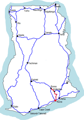 The N4 is indicated in red | ||||
| Route information | ||||
| Maintained by Ghana Highways Authority | ||||
| Length | 68.35 mi (110.00 km) | |||
| Major junctions | ||||
| South end |
| |||
| North end |
| |||
| Highway system | ||||
| ||||
The N4 or National Highway 4 is a national highway in Ghana that begins at the Tetteh Quarshie Interchange in Accra and runs through Adenta, Koforidua, and Asokore to join the N6, which continues on to Kumasi. It serves as an alternate route from Accra to Kumasi, with a total distance of 110 kilometers (68 miles).[1] The route runs through the Greater Accra and Eastern regions of Ghana.
Route
Major towns and cities along the route of the N4 include Madina, Adenta, Aburi, Mamfe, Koforidua, Asokore, and Bunso.
Greater Accra Region
The N4 begins at the Tetteh Quarshie Interchange in Accra and travels north, running by the University of Ghana at Legon. Continuing north to Madina, the N4 intersects with the R40 near the Madina Police Station and veers slightly northwest toward Oyarifa before entering the Eastern Region.
Eastern Region
In the Eastern Region, the N4 continues north to Aburi, where it intersects with the IR1 near the Aburi Botanical Gardens. The route continues north intersecting with the R22 at Mamfe,then turns west through Saforo and Kwamoso before veering northwest at Adawso toward Koforidua. At Koforidua, the N4 intersects with the R42 near the Koforidua Technical University and continues north to Asokore, where it intersects with the R41. From Asokore, the N4 turns northwest through New Tafo before terminating at Bunso, where it intersects with the R60 and N6, which continues north to Kumasi
See also
References