Murrays Crossroads, Georgia
| Murrays Crossroads | |
|---|---|
| Unincorporated community | |
 Murrays Crossroads Location within the state of Georgia  Murrays Crossroads Murrays Crossroads (the US) | |
| Coordinates: 32°19′16″N 84°17′40″W / 32.32111°N 84.29444°WCoordinates: 32°19′16″N 84°17′40″W / 32.32111°N 84.29444°W | |
| Country | United States |
| State | Georgia |
| County | Schley |
| Elevation | 440 ft (130 m) |
| Time zone | UTC-5 (Eastern (EST)) |
| • Summer (DST) | UTC-4 (EDT) |
| GNIS feature ID | 326414 |
Murrays Crossroads (also Murray, Murrays Cross Roads, and Poindexter) is an unincorporated community in Schley County, Georgia, United States. It lies at the intersection of U.S. Route 19 with State Route 240, to the north of the city of Ellaville, the county seat of Schley County.[1] Murrays Crossroads' elevation is 440 feet (134 m).[2]
The community is part of the Americus Micropolitan Statistical Area.
References
- ↑ Rand McNally. The Road Atlas '05. Skokie: Rand McNally, 2005, p. 28.
- ↑ U.S. Geological Survey Geographic Names Information System: Murrays Crossroads, Georgia, Geographic Names Information System, 1979-09-25. Accessed 2007-12-26.
Municipalities and communities of Schley County, Georgia, United States | ||
|---|---|---|
| City | 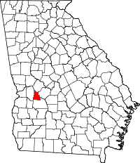 | |
| Unincorporated communities | ||
This article is issued from
Wikipedia.
The text is licensed under Creative Commons - Attribution - Sharealike.
Additional terms may apply for the media files.