Ellaville, Georgia
| Ellaville, Georgia | |
|---|---|
| City | |
 Location in Schley County and the state of Georgia | |
| Coordinates: 32°14′20″N 84°18′34″W / 32.23889°N 84.30944°WCoordinates: 32°14′20″N 84°18′34″W / 32.23889°N 84.30944°W | |
| Country | United States |
| State | Georgia |
| County | Schley |
| Area | |
| • Total | 3.2 sq mi (8.2 km2) |
| • Land | 3.2 sq mi (8.2 km2) |
| • Water | 0 sq mi (0 km2) |
| Elevation | 571 ft (174 m) |
| Population (2010) | |
| • Total | 1,812 |
| • Estimate (2016)[1] | 1,850 |
| • Density | 572/sq mi (221.0/km2) |
| Time zone | UTC-5 (Eastern (EST)) |
| • Summer (DST) | UTC-4 (EDT) |
| ZIP code | 31806 |
| Area code(s) | 229 |
| FIPS code | 13-26980[2] |
| GNIS feature ID | 0355674[3] |
Ellaville is a city in Schley County, Georgia, United States. The population was 1,812 at the 2010 census. The city is the county seat of Schley County.[4]
Ellaville is part of the Americus Micropolitan Statistical Area.
History
A town named Pond Town was established in 1812 along the stage coach in the area that is now the location of the Ellaville City Cemetery. Thea area was then part of the lands belonging to the Muscogee (Creek) Nation. In 1821, after the Treaty of Indian Springs the area became part of the state of Georgia. In 1826, it served as temporary county seat for Lee County upon the creation of the then vast county. Pond Town soon became a lively town noted for horse racing and whiskey. In 1831, the area became part of Sumter County. In 1840, twenty families migrated to Mississippi, which began the process of depopulating the town.
Ellaville was founded in 1857 as county seat of the newly formed Schley County. It was incorporated as a town in 1859.[5] The community was named after the daughter of a first settler.[6]
Geography
Ellaville is located at 32°14′20″N 84°18′34″W / 32.23889°N 84.30944°W (32.238921, -84.309526).[7]
According to the United States Census Bureau, the city has a total area of 3.2 square miles (8.3 km2), all land.
Demographics
| Historical population | |||
|---|---|---|---|
| Census | Pop. | %± | |
| 1880 | 182 | — | |
| 1900 | 474 | — | |
| 1910 | 672 | 41.8% | |
| 1920 | 693 | 3.1% | |
| 1930 | 764 | 10.2% | |
| 1940 | 928 | 21.5% | |
| 1950 | 886 | −4.5% | |
| 1960 | 905 | 2.1% | |
| 1970 | 1,391 | 53.7% | |
| 1980 | 1,684 | 21.1% | |
| 1990 | 1,724 | 2.4% | |
| 2000 | 1,609 | −6.7% | |
| 2010 | 1,812 | 12.6% | |
| Est. 2016 | 1,850 | [1] | 2.1% |
| U.S. Decennial Census[8] | |||
As of the census[2] of 2000, there were 7,438 people, 621 households, and 416 families residing in the city. The population density was 505.9 people per square mile (195.4/km²). There were 1,267 housing units at an average density of 217.9 per square mile (84.1/km²). The racial makeup of the city was 34.34% White, 62.74% African American, 0.19% Native American, 1.18% from other races, and 1.55% from two or more races. Hispanic or Latino of any race were 3.48% of the population.
There were 621 households out of which 35.9% had children under the age of 18 living with them, 40.4% were married couples living together, 22.7% had a female householder with no husband present, and 32.9% were non-families. 30.8% of all households were made up of individuals and 13.7% had someone living alone who was 65 years of age or older. The average household size was 2.57 and the average family size was 3.22.
In the city, the population was spread out with 31.5% under the age of 18, 8.3% from 18 to 24, 25.8% from 25 to 44, 22.2% from 45 to 64, and 12.2% who were 65 years of age or older. The median age was 33 years. For every 100 females, there were 80.8 males. For every 100 females age 18 and over, there were 77.5 males.
The median income for a household in the city was $25,724, and the median income for a family was $33,409. Males had a median income of $29,500 versus $21,615 for females. The per capita income for the city was $13,320. About 22.2% of families and 26.3% of the population were below the poverty line, including 30.7% of those under age 18 and 33.3% of those age 65 or over.
Education
Schley County School District
The Schley County School District holds pre-school to grade twelve, and consists of one elementary school and one middle-high school.[9] The district has 66 full-time teachers and over 1,126 students.[10]
- Schley County Elementary School
- Schley Middle High School
Notable people
References
- 1 2 "Population and Housing Unit Estimates". Retrieved June 9, 2017.
- 1 2 "American FactFinder". United States Census Bureau. Retrieved 2008-01-31.
- ↑ "US Board on Geographic Names". United States Geological Survey. 2007-10-25. Retrieved 2008-01-31.
- ↑ "Find a County". National Association of Counties. Archived from the original on 2011-05-31. Retrieved 2011-06-07.
- ↑ Hellmann, Paul T. (May 13, 2013). Historical Gazetteer of the United States. Routledge. p. 229. Retrieved 30 November 2013.
- ↑ Krakow, Kenneth K. (1975). Georgia Place-Names: Their History and Origins (PDF). Macon, GA: Winship Press. p. 71. ISBN 0-915430-00-2.
- ↑ "US Gazetteer files: 2010, 2000, and 1990". United States Census Bureau. 2011-02-12. Retrieved 2011-04-23.
- ↑ "Census of Population and Housing". Census.gov. Archived from the original on May 12, 2015. Retrieved June 4, 2015.
- ↑ Georgia Board of Education, Retrieved June 26, 2010.
- ↑ School Stats, Retrieved June 26, 2010.
External links
Municipalities and communities of Schley County, Georgia, United States | ||
|---|---|---|
| City | 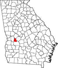 | |
| Unincorporated communities | ||