Municipalities of Hidalgo
.svg.png)
Hidalgo is a state in East Mexico that is divided into 84 municipalities.[1]
Municipalities in Hidalgo are administratively autonomous of the state according to the 115th article of the 1917 Constitution of Mexico.[2] Every three years, citizens elect a municipal president (Spanish: presidente municipal) by a plurality voting system who heads a concurrently elected municipal council (ayuntamiento) responsible for providing all the public services for their constituents. The municipal council consists of a variable number of trustees and councillors (regidores y síndicos).[3] Municipalities are responsible for public services (such as water and sewerage), street lighting, public safety, traffic, supervision of slaughterhouses and the maintenance of public parks, gardens and cemeteries.[4] They may also assist the state and federal governments in education, emergency fire and medical services, environmental protection and maintenance of monuments and historical landmarks. Since 1984, they have had the power to collect property taxes and user fees, although more funds are obtained from the state and federal governments than from their own income.[4]
Municipalities
- Largest municipalities in Hidalgo by population
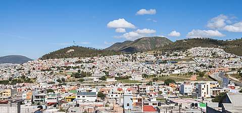 Pachuca de Soto, Hidalgo's capital and largest municipality by population
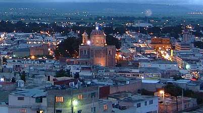 Tulancingo de Bravo is the second largest municipality in Hidalgo by population
References
- 1 2 "Número de habitantes". INEGI (National Institute of Statistics and Geography). Retrieved July 15, 2017.
- ↑ "Constitución Política de los Estados Unidos Mexicanos". Article 115, of 1917 (in Spanish). Retrieved September 27, 2017.
- ↑ OECD (November 12, 2004). New Forms of Governance for Economic Development. OECD Publishing. p. 121. ISBN 9264015329.
- 1 2 International Business Publications (2009). Mexico Company Laws and Regulations Handbook. p. 42. ISBN 1-4330-7030-8.
- ↑ "Tabulados de la Encuesta Intercensal 2015" (xls) (in Spanish). INEGI. Retrieved July 15, 2017.
- ↑ "Localidades y su población por municipio según tamaño de localidad" (PDF) (in Spanish). INEGI. February 28, 2011. Retrieved July 15, 2017.
- ↑ "Unidad de Microrregiones, Cédulas de Información Municipal (SCIM)" (in Spanish). SEDESOL. Retrieved November 18, 2017.
- ↑ Estado de Colima. División Territorial de 1810 a 1995 (PDF) (in Spanish). Mexico: INEGI. 1996. p. 79. ISBN 970-13-1491-3.