Mrzla Planina
| Mrzla Planina | |
|---|---|
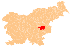
 Mrzla Planina Location in Slovenia | |
| Coordinates: 46°3′20.28″N 15°23′41.8″E / 46.0556333°N 15.394944°ECoordinates: 46°3′20.28″N 15°23′41.8″E / 46.0556333°N 15.394944°E | |
| Country |
|
| Traditional region | Styria |
| Statistical region | Lower Sava |
| Municipality | Sevnica |
| Area | |
| • Total | 6.69 km2 (2.58 sq mi) |
| Elevation | 661.3 m (2,169.6 ft) |
| Population (2002) | |
| • Total | 127 |
| [1] | |
Mrzla Planina (pronounced [ˈməɾzla plaˈniːna]) is a dispersed settlement in the hills northeast of Sevnica in east-central Slovenia. The area is part of the historical region of Styria. The municipality is now included in the Lower Sava Statistical Region.[2]
The local church just north of the hamlet of Pokojni Vrh is dedicated to Saints Primus and Felician and belongs to the Parish of Zabukovje. It is probably of Romanesque origin, but was extensively rebuilt in the 17th century.[3]
References
- ↑ Statistical Office of the Republic of Slovenia
- ↑ Sevnica municipal site
- ↑ "EŠD 3515". Registry of Immovable Cultural Heritage (in Slovenian). Ministry of Culture of the Republic of Slovenia. Retrieved 13 October 2011.
External links
This article is issued from
Wikipedia.
The text is licensed under Creative Commons - Attribution - Sharealike.
Additional terms may apply for the media files.