Mouzaki
| Mouzaki Μουζάκι | |
|---|---|
 Mouzaki municipality map | |
 Mouzaki Location within the region  | |
| Coordinates: 39°26′N 21°40′E / 39.433°N 21.667°ECoordinates: 39°26′N 21°40′E / 39.433°N 21.667°E | |
| Country | Greece |
| Administrative region | Thessaly |
| Regional unit | Karditsa |
| Area | |
| • Municipality | 313.9 km2 (121.2 sq mi) |
| • Municipal unit | 179.5 km2 (69.3 sq mi) |
| Population (2011)[1] | |
| • Municipality | 13,122 |
| • Municipality density | 42/km2 (110/sq mi) |
| • Municipal unit | 7,291 |
| • Municipal unit density | 41/km2 (110/sq mi) |
| Community[1] | |
| • Population | 1,961 (2011) |
| Time zone | UTC+2 (EET) |
| • Summer (DST) | UTC+3 (EEST) |
| Vehicle registration | ΚΑ |
Mouzaki (Greek: Μουζάκι) is a town and a municipality in the northwestern part of the Karditsa regional unit, Greece. Mouzaki is located on the southwestern edge of the Thessalian plain, where the river Pamisos descends from the Agrafa mountains. It is 17 km southwest of Trikala and 24 km northwest of Karditsa. The Greek National Road 30 (Arta - Trikala - Karditsa - Volos) passes north of the town.
Municipality
The municipality Mouzaki was formed at the 2011 local government reform by the merger of the following 3 former municipalities, that became municipal units:[2]
The municipality has an area of 313.866 km2, the municipal unit 179.521 km2.[3]
Subdivisions
The municipal unit of Mouzaki is divided into the following communities (constituent settlements in brackets):
- Amygdali
- Anthochori (Anthochori, Anoixiatiko, Platanakos)
- Drakotrypa (Drakotrypa, Arpakia, Keramargio, Milies, Spathes, Trygona, Tsarouchi)
- Ellinokastro (Ellinokastro, Gravia, Petrota)
- Gelanthi
- Kryopigi (Kryopigi, Lakkes, Xirokampos)
- Lazarina
- Magoulitsa
- Mavrommati (Mavrommati, Georgios Karaiskakis)
- Mouzaki
- Oxya (Oxya, Vagenia, Dafni, Zamanatiko, Koura, Megali Vrysi, Mesorrachi, Palaiampela, Palaiochori, Platania, Soula, Sykia)
- Pefkofyto (Pefkofyto, Nisia, Padi, Charavgi)
- Porti (Porti, Martini, Meligos, Palaiokastro)
- Vatsounia
Population
| Year | Town | Municipal unit | Municipality |
|---|---|---|---|
| 1981 | 2,560 | - | - |
| 1991 | 2,353 | - | - |
| 2001 | 2,190 | 10,148 | - |
| 2011 | 1,961 | 7,291 | 13,122 |
External links
References
- 1 2 "Απογραφή Πληθυσμού - Κατοικιών 2011. ΜΟΝΙΜΟΣ Πληθυσμός" (in Greek). Hellenic Statistical Authority.
- ↑ Kallikratis law Greece Ministry of Interior (in Greek)
- ↑ "Population & housing census 2001 (incl. area and average elevation)" (PDF) (in Greek). National Statistical Service of Greece.
Administrative division of the Thessaly Region | ||
|---|---|---|
| Regional unit of Karditsa | 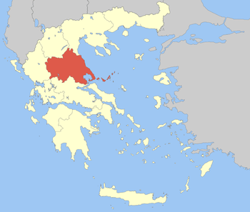 | |
| Regional unit of Larissa | ||
| Regional unit of Magnesia | ||
| Regional unit of the Sporades | ||
| Regional unit of Trikala | ||
| ||
This article is issued from
Wikipedia.
The text is licensed under Creative Commons - Attribution - Sharealike.
Additional terms may apply for the media files.