Drakotrypa
| Drakotrypa Δρακότρυπα | |
|---|---|
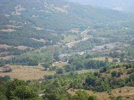 The village Trygona | |
 Drakotrypa | |
| Coordinates: 39°24′N 21°36′E / 39.400°N 21.600°ECoordinates: 39°24′N 21°36′E / 39.400°N 21.600°E | |
| Country | Greece |
| Administrative region | Thessaly |
| Regional unit | Karditsa |
| Municipality | Mouzaki |
| Municipal unit | Mouzaki |
| Community[1] | |
| • Population | 562 (2011) |
| Time zone | UTC+2 (EET) |
| • Summer (DST) | UTC+3 (EEST) |
| Vehicle registration | ΚΑ |
Drakotrypa (Greek: Δρακότρυπα) is a mountain village and a community in the municipality of Mouzaki, in the western part of the Karditsa regional unit, Greece. The community consists of the villages Drakotrypa, Arpakia, Keramargio, Milies, Spathes, Trygona and Tsarouchi. Drakotrypa is located at the foot of the Pindus mountains, 6 km southwest of Mouzaki and 28 km west of Karditsa.
Population
| Year | Population |
|---|---|
| 2001 | 690 |
| 2011 | 562 |
External links
See also
References
- ↑ "Απογραφή Πληθυσμού - Κατοικιών 2011. ΜΟΝΙΜΟΣ Πληθυσμός" (in Greek). Hellenic Statistical Authority.
This article is issued from
Wikipedia.
The text is licensed under Creative Commons - Attribution - Sharealike.
Additional terms may apply for the media files.