Ithomi, Karditsa
| Ithomi Ιθώμη | |
|---|---|
 Ithomi Location within the regional unit 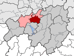 | |
| Coordinates: 39°24′N 21°47′E / 39.400°N 21.783°ECoordinates: 39°24′N 21°47′E / 39.400°N 21.783°E | |
| Country | Greece |
| Administrative region | Thessaly |
| Regional unit | Karditsa |
| Municipality | Mouzaki |
| • Municipal unit | 80.5 km2 (31.1 sq mi) |
| Population (2011)[1] | |
| • Municipal unit | 2,044 |
| • Municipal unit density | 25/km2 (66/sq mi) |
| Time zone | UTC+2 (EET) |
| • Summer (DST) | UTC+3 (EEST) |
| Vehicle registration | ΚΑ |
Ithomi (Greek: Ιθώμη) is a former municipality in the Karditsa regional unit, Thessaly, Greece. Since the 2011 local government reform it is part of the municipality Mouzaki, of which it is a municipal unit.[2] The municipal unit has an area of 80.491 km2.[3] Population 2,044 (2011). The seat of the municipality was in Fanari. The name reflects the ancient town of Ithome, which, although its location is uncertain, is thought to be located nearby.
References
- ↑ "Απογραφή Πληθυσμού - Κατοικιών 2011. ΜΟΝΙΜΟΣ Πληθυσμός" (in Greek). Hellenic Statistical Authority.
- ↑ Kallikratis law Greece Ministry of Interior (in Greek)
- ↑ "Population & housing census 2001 (incl. area and average elevation)" (PDF) (in Greek). National Statistical Service of Greece. Archived from the original (PDF) on 2015-09-21.
This article is issued from
Wikipedia.
The text is licensed under Creative Commons - Attribution - Sharealike.
Additional terms may apply for the media files.