Mount Storm, West Virginia
| Mount Storm, West Virginia | |
|---|---|
| Unincorporated community | |
_at_the_junction_with_West_Virginia_State_Route_42_(Union_Highway)_in_Mount_Storm%2C_Grant_County%2C_West_Virginia.jpg) View east along US 50 entering Mount Storm | |
 Mount Storm  Mount Storm | |
| Coordinates: 39°16′38″N 79°14′27″W / 39.27722°N 79.24083°WCoordinates: 39°16′38″N 79°14′27″W / 39.27722°N 79.24083°W | |
| Country | United States |
| State | West Virginia |
| County | Grant |
| Population (2000) | |
| • Total | 109 |
| Time zone | UTC-5 (Eastern (EST)) |
| • Summer (DST) | UTC-4 (EDT) |
| GNIS feature ID | 1543766[1] |
Mount Storm is an unincorporated community in Grant County, West Virginia, United States. Mount Storm lies on the Northwestern Turnpike (U.S. Route 50) at its junction with West Virginia Route 42. The community is the site of the Union School Complex, which contains Union High School.
Inclement weather over a nearby mountain caused the name of the town to be selected.[2]
Climate
The climate in this area has mild differences between highs and lows, and there is adequate rainfall year-round. According to the Köppen Climate Classification system, Mount Storm has a marine west coast climate, abbreviated "Cfb" on climate maps.
References
- ↑ U.S. Geological Survey Geographic Names Information System: Mount Storm, West Virginia
- ↑ Kenny, Hamill (1945). West Virginia Place Names: Their Origin and Meaning, Including the Nomenclature of the Streams and Mountains. Piedmont, WV: The Place Name Press. p. 432.
External links
Municipalities and communities of Grant County, West Virginia, United States | ||
|---|---|---|
| City | 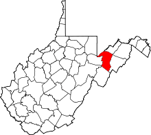 | |
| Town | ||
| Unincorporated communities | ||
| Footnotes | ‡This populated place also has portions in an adjacent county or counties | |
This article is issued from
Wikipedia.
The text is licensed under Creative Commons - Attribution - Sharealike.
Additional terms may apply for the media files.