Mount Habel
| Mount Habel | |
|---|---|
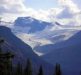 Mount Habel seen from Peyto Lake Overlook | |
| Highest point | |
| Elevation | 3,087 m (10,128 ft) [1] |
| Prominence | 227 m (745 ft) |
| Coordinates | 51°38′54″N 116°34′18″W / 51.64833°N 116.57167°WCoordinates: 51°38′54″N 116°34′18″W / 51.64833°N 116.57167°W |
| Geography | |
 Mount Habel Location in Alberta and British Columbia | |
| Location |
Alberta British Columbia |
| Parent range | Park Ranges |
| Topo map | NTS 82N/10 |
| Climbing | |
| First ascent | 1923 A. Geoffrion, JWA Hickson, E. Feuz Jr. |
Mount Habel is located on the border of Alberta and British Columbia. It was named in 1986 after Habel, Jean.[1][2]
See also
References
This article is issued from
Wikipedia.
The text is licensed under Creative Commons - Attribution - Sharealike.
Additional terms may apply for the media files.