Mount Custer
| Mount Custer | |
|---|---|
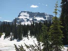 Mount Custer from Summit Lake | |
| Highest point | |
| Elevation | 8,888 ft (2,709 m) [1] NAVD 88 |
| Prominence | 1,203 ft (367 m) [1] |
| Parent peak | Chapman Peak[1] |
| Coordinates | 48°58′49″N 114°03′29″W / 48.98028°N 114.05806°WCoordinates: 48°58′49″N 114°03′29″W / 48.98028°N 114.05806°W [2] |
| Geography | |
 Mount Custer | |
| Parent range | Livingston Range |
| Topo map | USGS Mount Carter, MT |
Mount Custer (8,888 feet (2,709 m)) is located in the Livingston Range, Glacier National Park in the U.S. state of Montana.[3] Situated along the Continental Divide, Mount Custer rises more than 3,300 feet (1,000 m) above Lake Nooney, located below the summit to the east. Herbst Glacier is immediately northeast of the peak.
See also
References
- 1 2 3 "Mount Custer, Montana". Peakbagger.com. Retrieved June 7, 2018.
- ↑ "Mount Custer". Geographic Names Information System. United States Geological Survey. Retrieved June 7, 2018.
- ↑ Mount Carter, MT (Map). TopoQwest (United States Geological Survey Maps). Retrieved June 7, 2018.
This article is issued from
Wikipedia.
The text is licensed under Creative Commons - Attribution - Sharealike.
Additional terms may apply for the media files.