Mount Bowlen
| Mount Bowlen | |
|---|---|
 Mount Bowlen | |
| Highest point | |
| Elevation | 3,206 m (10,518 ft) [1] |
| Prominence | 170 m (560 ft) |
| Coordinates | 51°18′06″N 116°11′22″W / 51.30167°N 116.18944°WCoordinates: 51°18′06″N 116°11′22″W / 51.30167°N 116.18944°W [2] |
| Geography | |
 Mount Bowlen Location in Alberta and British Columbia | |
| Location | Alberta / British Columbia |
| Parent range | Bow Range |
| Topo map | NTS 82N/08 |
| Climbing | |
| First ascent | 1901 G.T. Little, Charles S. Thompson, G.M. Weed, Hans Kaufmann[1] |
| Easiest route | Peak 3 |
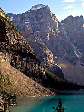
Mount Bowlen is located on the border of Alberta and British Columbia and forms part of the Valley of the Ten Peaks. It was named in 1953 after John J. Bowlen, a native of Prince Edward Island, successful Alberta rancher, honorary chief of the Blackfoot, and a Lieutenant Governor of Alberta. Its former name was "Yamnee", which translates to the number 3 in the local Nakoda (Stoney) language.[1][3]
See also
Further reading
• Dave Birrell, 50 Roadside Panoramas in the Canadian Rockies, P 87
• Western Canada, P 280
• Paul Zizka, Summits and Starlight: The Canadian Rockies
References
- 1 2 3 "Mount Bowlen". PeakFinder.com. Retrieved 2010-02-11.
- ↑ "Mount Bowlen". BC Geographical Names. Retrieved 2013-06-29.
- ↑ Boles, len W.; Laurilla, Roger W.; Putnam, William L. (2006). Canadian Mountain Place Names. Vancouver: Rocky Mountain Books. pp. 47–48. ISBN 978-1-894765-79-4.
This article is issued from
Wikipedia.
The text is licensed under Creative Commons - Attribution - Sharealike.
Additional terms may apply for the media files.