Mount Bolanos
| Mount Bolanos | |
|---|---|
 Mount Bolanos | |
| Highest point | |
| Elevation | 368 m (1,207 ft) [1] |
| Coordinates | 13°17′53″N 144°41′06″E / 13.29806°N 144.68500°ECoordinates: 13°17′53″N 144°41′06″E / 13.29806°N 144.68500°E [2] |
| Geography | |
| Location | Guam, Micronesia, U.S. territory |
| Topo map | USGS Agat |
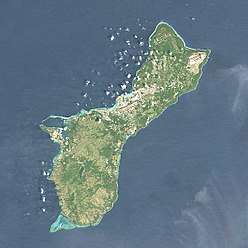
Mount Bolanos is a south-west peak in the United States territory of Guam.
Rising to 368 meters (1,207 ft) above sea level, it is the 3rd highest peak in Guam (after Mount Lamlam and Mount Jumullong Manglo, and before Mount Almagosa).[3]
Nearby are located the Bolanos Conservation Reserve (0.4 km[4]) and the Bolanos River (1.6 km[4]). The closest populated places are the villages of Umatac (4.5 km[4]) and Agat (9 km[5]). Farther to the north is the capital Hagåtña (25 km).
References
- ↑ "Mount Bolanos". Encyclopædia Britannica Online. Retrieved 2014-05-25.
- ↑ "Mount Bolanos". Geographic Names Information System. United States Geological Survey. Retrieved 2014-05-25.
- ↑ "Highest Mountain Peaks in Guam". MountainZone.com. Archived from the original on 2013-10-29.
- 1 2 3 "Mount Bolanos". TravelingLuck.com. Retrieved 2014-05-25.
- ↑ "Mount Bolanos". MountainZone.com.
Hagåtña (capital) | |
| Topics | |
| Islands | |
| Villages | |
| Peaks |
|
This article is issued from
Wikipedia.
The text is licensed under Creative Commons - Attribution - Sharealike.
Additional terms may apply for the media files.