Mount Ansel Adams
| Mount Ansel Adams | |
|---|---|
 Mount Ansel Adams  Mount Ansel Adams | |
| Highest point | |
| Elevation | 11,766+ ft (3586+ m) NAVD 88[1] |
| Prominence | 160 feet (49 m) |
| Coordinates | 37°41′52″N 119°16′53″W / 37.6977103°N 119.281255°WCoordinates: 37°41′52″N 119°16′53″W / 37.6977103°N 119.281255°W [2] |
| Geography | |
| Location |
Yosemite National Park Madera County, California, U.S. |
| Parent range | Sierra Nevada |
| Topo map | USGS Mount Lyell |
| Climbing | |
| First ascent | July 11, 1934 by Glen Dawson, Jack Riegelhuth and Neil Ruge[3] |
| Easiest route | Exposed scramble, class 3[3] |
Mount Ansel Adams is a peak in the Sierra Nevada of California. The summit is in Yosemite National Park near the park's eastern boundary. It lies 0.8 miles (1.3 km) northeast of Foerster Peak and 1.3 miles (2.1 km) west-southwest of Electra Peak[2] at the head of the Lyell Fork of the Merced River. It was named in 1985 for Ansel Adams, the preeminent landscape photographer, conservationist,[2] and member of the Board of Directors of the Sierra Club, a role he maintained for 37 years.[4][5]
References
- ↑ "Mount Ansel Adams, California". Peakbagger.com.
- 1 2 3 "Mount Ansel Adams". Geographic Names Information System. United States Geological Survey.
- 1 2 Secor, R.J. (2009). The High Sierra Peaks, Passes, and Trails (3rd ed.). Seattle: The Mountaineers. p. 414. ISBN 9780898869712.
- ↑ "About Ansel Adams". Sierra Club. Retrieved 2014-12-14.
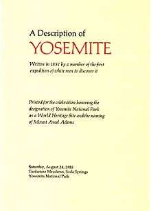
- ↑ A Description of Yosemite (1851). Printed for the celebration honoring the designation of Yosemite National Park as a World Heritage Site and the naming of Mount Ansel Adams, Saturday, August 24, 1985, Tuolumne Meadows, Soda Springs, Yosemite National Park. Designed and printed by Adrian Wilson at the Press in Tuscany Alley, San Francisco.
 Description of Yosemite-01 Bunnell 1851
This article is issued from
Wikipedia.
The text is licensed under Creative Commons - Attribution - Sharealike.
Additional terms may apply for the media files.