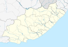
Motherwell, Eastern Cape
| Motherwell | |
|---|---|
 Motherwell  Motherwell Motherwell (South Africa)  Motherwell Motherwell (Africa) | |
| Coordinates: 33°48′14″S 25°34′48″E / 33.804°S 25.580°ECoordinates: 33°48′14″S 25°34′48″E / 33.804°S 25.580°E | |
| Country | South Africa |
| Province | Eastern Cape |
| Municipality | Nelson Mandela Bay |
| Established | 1984 |
| Area[1] | |
| • Total | 25.86 km2 (9.98 sq mi) |
| Population (2011)[1] | |
| • Total | 140,351 |
| • Density | 5,400/km2 (14,000/sq mi) |
| Racial makeup (2011)[1] | |
| • Black African | 99.2% |
| • Coloured | 0.3% |
| • Indian/Asian | 0.1% |
| • White | 0.1% |
| • Other | 0.4% |
| First languages (2011)[1] | |
| • Xhosa | 93.1% |
| • English | 2.9% |
| • Other | 4.0% |
| Time zone | UTC+2 (SAST) |
| Postal code (street) | 6211 |
| PO box | 6213 |
Motherwell is a town/suburb/township in Nelson Mandela Bay Metropolitan Municipality in the Eastern Cape province of South Africa.
Motherwell was planned to accommodate the black squatters who were relocated from Zwide and Veeplaas, and construction began in 1984.[2] It is the largest settlement in terms of population and land area in Port Elizabeth.
It is separated into blocks called "NU"s (e.g.NU5 or NU8) from 1 to 13, then 29. Motherwell has a number of public schools, both at primary and secondary level. It also has a clinic; a day hospital; library; numerous public parks; community centers. Retailers such as Shoprite; Spar; Boxer Superstores; PEP, and national restaurant chains Debonairs; Steers; and Chesa Nyama also have a presence in Motherwell.
National Commercial Banks Standard Bank (founded in Port Elizabeth); ABSA; Capitec Bank; First National Bank; and Nedbank have branches and multiple ATMs available.
References
- 1 2 3 4 "Main Place Motherwell". Census 2011.
- ↑ "Motherwell Urban Renewal Programme". Nelson Mandela Bay Municipality. Retrieved 25 August 2013.
.svg.png)