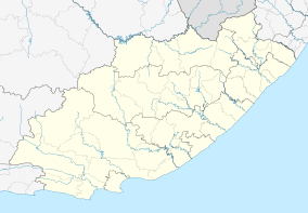
Ibhayi
| iBhayi eBhayi | |
|---|---|
 iBhayi  iBhayi iBhayi (South Africa)  iBhayi iBhayi (Africa) | |
| Coordinates: 33°52′19″S 25°34′16″E / 33.872°S 25.571°ECoordinates: 33°52′19″S 25°34′16″E / 33.872°S 25.571°E | |
| Country | South Africa |
| Province | Eastern Cape |
| Municipality | Nelson Mandela Bay |
| Area[1] | |
| • Total | 36.06 km2 (13.92 sq mi) |
| Population (2011)[1] | |
| • Total | 237,799 |
| • Density | 6,600/km2 (17,000/sq mi) |
| Racial makeup (2011)[1] | |
| • Black African | 98.6% |
| • Coloured | 0.9% |
| • Indian/Asian | 0.1% |
| • White | 0.1% |
| • Other | 0.3% |
| First languages (2011)[1] | |
| • Xhosa | 91.5% |
| • English | 3.4% |
| • Afrikaans | 1.5% |
| • Other | 3.5% |
| Time zone | UTC+2 (SAST) |
| Postal code (street) | 6001 |
Ibhayi is a large township near Port Elizabeth, South Africa.
Subdivisions
- KwaZakele 1, 2, and 3
- New Brighton
- Soweto On Sea
- Zwide 1, 2, 3, and 4
are all part of Ibhayi. - Motherwell
- KwaMagxaki
- KwaDwesi
- KwaNoxolo
- Joe Slovo
- KwaDwesi Extension
- Rholihlahla
The Ubuntu Education Fund is based in Zwide, and operates a community center which opened in 2010.[2]
IBhayi has a local township pub located in Zwide, called Oom Colas Tarven or widely known as KwaGqalane.
Another is Chief Nqoko in New Brighton, but most people fear this one because of regular gun shots.
Demographics (2011)
- Area: 36.06 square kilometres (13.92 sq mi)
- Population: 237,799: 6,594 inhabitants per square kilometre (17,080/sq mi)
- Households: 63,474: 1,760 per square kilometre (4,600/sq mi)
| Gender | Population | % |
|---|---|---|
| Female | 124,569 | 52.38 |
| Male | 113,230 | 47.62 |
| Race | Population | % |
|---|---|---|
| Black | 234,531 | 98.63 |
| White | 230 | 0.1 |
| Coloured | 2,047 | 0.86 |
| Asian | 230 | 0.1 |
Source:[3]
| Historical population | ||
|---|---|---|
| Year | Pop. | ±% |
| 1985 | 220,548 | — |
| 1991 | 257,054 | +16.6% |
| 2001 | 255,826 | −0.5% |
| 2011 | 237,799 | −7.0% |
| [4] | ||
References
- 1 2 3 4 "Main Place iBhayi". Census 2011.
- ↑ Bixler, Lily (6 October 2010). "Local architects design South African community center". Half Moon Bay Review.
- ↑ "Main Place Ibhayi" Census 2011
- ↑ Nelson Mandela Bay: Metropolitan Municipality & Main Places - Statistics & Maps on City Population
This article is issued from
Wikipedia.
The text is licensed under Creative Commons - Attribution - Sharealike.
Additional terms may apply for the media files.
.svg.png)