Moshoeshoe I International Airport
| Moshoeshoe International Airport | |||||||||||||||
|---|---|---|---|---|---|---|---|---|---|---|---|---|---|---|---|
.jpg) | |||||||||||||||
| Summary | |||||||||||||||
| Airport type | Public | ||||||||||||||
| Operator | Department of Civil Aviation | ||||||||||||||
| Serves | Maseru, Lesotho | ||||||||||||||
| Location | Mazenod | ||||||||||||||
| Elevation AMSL | 5,348 ft / 1,630 m | ||||||||||||||
| Coordinates | 29°27′44″S 027°33′09″E / 29.46222°S 27.55250°E | ||||||||||||||
| Map | |||||||||||||||
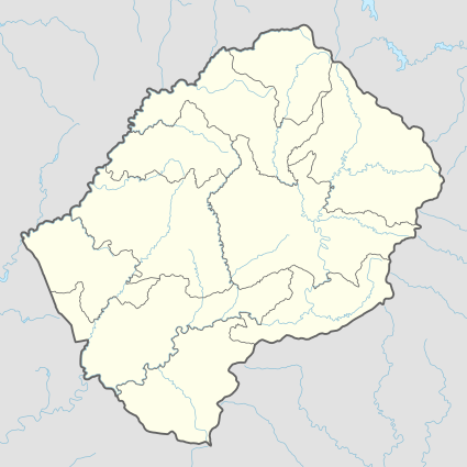
 MSU Location of Airport in Lesotho | |||||||||||||||
| Runways | |||||||||||||||
| |||||||||||||||
Moshoeshoe I International Airport (IATA: MSU, ICAO: FXMM) is an airport serving Maseru, the capital city of Lesotho. The airport is named in honor of Moshoeshoe I, king of Lesotho in the 1850s. It is in the town of Mazenod, 18 km (11 mi) southeast of downtown Maseru.
Runway length includes a 200 metres (660 ft) displaced threshold on Runway 04.
The Mazenod VOR-DME (Ident: MZV) is 2.0 nautical miles (3.7 km) off the approach threshold of Runway 04. The Beria non-directional beacon (Ident: ME) is 1.35 nautical miles (2.5 km) off the approach threshold of Runway 22.[4][5]
Facilities
The airport has an elevation of 5,348 feet (1,630 m) above mean sea level. It has two asphalt runways: 04/22 measuring 3,200 by 45 metres (10,499 ft × 148 ft) and 11/29 measuring 1,010 m × 23 m (3,314 ft × 75 ft).[1]
Airlines and destinations
| Airlines | Destinations |
|---|---|
| Airlink | Johannesburg–O. R. Tambo |
See also
References
- 1 2 Airport information for Moshoeshoe International Airport
- ↑ Airport information for Moshoeshoe International Airport at Great Circle Mapper.
- ↑ Moshoeshoe - SkyVector
- ↑ "Mazenod VOR-DME (MZV) @ OurAirports". ourairports.com. Retrieved 2018-08-21.
- ↑ "Berea NDB (ME) @ OurAirports". ourairports.com. Retrieved 2018-08-21.
External links
- Moshoeshoe I International Airport at Lesotho Department of Civil Aviation
- OpenStreetMap - Moshoeshoe
- Current weather for Moshoeshoe I International Airport at NOAA/NWS
- Accident history for Moshoeshoe I International Airport at Aviation Safety Network
- Google Maps - Moshoeshoe