Moor, Nevada
| Moor, Nevada | |
|---|---|
| Ghost town | |
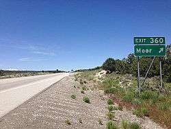 Moor exit on Interstate 80 | |
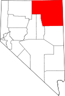
 Moor, Nevada Location in the state of Nevada  Moor, Nevada Moor, Nevada (the US) | |
| Coordinates: 41°07′02″N 114°48′54″W / 41.11722°N 114.81500°WCoordinates: 41°07′02″N 114°48′54″W / 41.11722°N 114.81500°W | |
| Country | United States |
| State | Nevada |
| County | Elko |
| Elevation | 6,158 ft (1,877 m) |
| Time zone | UTC-8 (PST) |
| • Summer (DST) | UTC-7 (PDT) |
Moor is a ghost town in Elko County, Nevada, United States.[1] It is located along Interstate 80 between Wells and West Wendover.
History
The first settlement at Moor was made in 1869.[2] Variant names were "Moor Siding", "Moores", and "Moors".[1] The community was named after a railroad employee.[3] In 1941, Moor had 17 inhabitants.[2]
References
- 1 2 U.S. Geological Survey Geographic Names Information System: Moor
- 1 2 Federal Writers' Project (1941). Origin of Place Names: Nevada (PDF). W.P.A. p. 27.
- ↑ Carlson, Helen S. (1974). Nevada Place Names: A Geographical Dictionary. University of Nevada Press. p. 171. ISBN 978-0-87417-094-8.
This article is issued from
Wikipedia.
The text is licensed under Creative Commons - Attribution - Sharealike.
Additional terms may apply for the media files.