Deeth, Nevada
| Deeth, Nevada | |
|---|---|
| Unincorporated community & Census-designated places | |
_in_Deeth%2C_Nevada.JPG) Buildings in Deeth | |
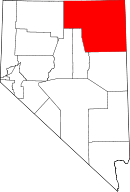
 Deeth, Nevada Location within the state of Nevada | |
| Coordinates: 41°03′56″N 115°16′29″W / 41.06556°N 115.27472°WCoordinates: 41°03′56″N 115°16′29″W / 41.06556°N 115.27472°W | |
| Country | United States |
| State | Nevada |
| County | Elko |
| Time zone | UTC-8 (Pacific (PST)) |
| • Summer (DST) | UTC-7 (PDT) |
Deeth is an unincorporated community and census-designated places near the intersection of Interstate 80 and Nevada State Route 230 in Elko County, Nevada, United States.
History
When the Central Pacific started running past this site in 1869, a branch line station with telegraph was established. In 1875, a post office was established for nearby ranches and farms. The community was named after a pioneer citizen.[1][2]
As ranching and mining activity increased in the area the town grew in size. The Western Pacific began running thru Deeth in 1910. At the time, the community had mercantile stores, a Mormon church, livery stables, hotels, saloons, a blacksmith and a population of approximately 250. Many dairies and farms were in the county and this town served as a depot to ship cattle and a trading center for local ranchers and ranchers from nearby counties.[2]
In 1915, a fire destroyed most of the town. The post office has been in operation at Deeth since 1875.[3][4] Little remains of the original community.[5]
Climate
According to the Köppen Climate Classification system, Deeth has a warm-summer humid continental climate, abbreviated "Dfb" on climate maps.
| Climate data for Deeth | |||||||||||||
|---|---|---|---|---|---|---|---|---|---|---|---|---|---|
| Month | Jan | Feb | Mar | Apr | May | Jun | Jul | Aug | Sep | Oct | Nov | Dec | Year |
| Record high °F (°C) | 63 (17) |
69 (21) |
78 (26) |
84 (29) |
93 (34) |
99 (37) |
101 (38) |
100 (38) |
98 (37) |
86 (30) |
75 (24) |
62 (17) |
101 (38) |
| Average high °F (°C) | 35.5 (1.9) |
40.2 (4.6) |
48.7 (9.3) |
58.9 (14.9) |
68.3 (20.2) |
77.6 (25.3) |
87.9 (31.1) |
86.3 (30.2) |
77.6 (25.3) |
64.9 (18.3) |
47.9 (8.8) |
36.8 (2.7) |
60.9 (16.1) |
| Average low °F (°C) | 8.8 (−12.9) |
13.5 (−10.3) |
20.5 (−6.4) |
26.5 (−3.1) |
33.9 (1.1) |
39.7 (4.3) |
43.3 (6.3) |
40.6 (4.8) |
32.2 (0.1) |
23.1 (−4.9) |
16.9 (−8.4) |
9.6 (−12.4) |
25.7 (−3.5) |
| Record low °F (°C) | −36 (−38) |
−31 (−35) |
−22 (−30) |
5 (−15) |
9 (−13) |
19 (−7) |
26 (−3) |
18 (−8) |
8 (−13) |
−5 (−21) |
−18 (−28) |
−42 (−41) |
−42 (−41) |
| Average precipitation inches (mm) | 1.16 (29.5) |
0.87 (22.1) |
1.19 (30.2) |
1.38 (35.1) |
1.69 (42.9) |
1.13 (28.7) |
0.41 (10.4) |
0.47 (11.9) |
0.75 (19) |
0.83 (21.1) |
1.12 (28.4) |
1.03 (26.2) |
12.02 (305.3) |
| Average snowfall inches (cm) | 5.9 (15) |
3 (8) |
3.2 (8.1) |
1.9 (4.8) |
0.4 (1) |
0 (0) |
0 (0) |
0 (0) |
0 (0) |
0.3 (0.8) |
1.8 (4.6) |
5 (13) |
21.6 (54.9) |
| Average precipitation days | 7 | 6 | 8 | 7 | 7 | 5 | 3 | 3 | 3 | 4 | 6 | 6 | 65 |
| Source: WRCC[6] | |||||||||||||
References
- ↑ Federal Writers' Project (1941). Origin of Place Names: Nevada (PDF). W.P.A. p. 23.
- 1 2 Paher, Stanley (1970). Nevada Ghost Towns and Mining Camps. Howell North. p. 220.
- ↑ "Post Offices". Jim Forte Postal History. Retrieved 10 April 2018.
- ↑ U.S. Geological Survey Geographic Names Information System: Deeth Post Office
- ↑ "Deeth". Ghosttowns.com. Retrieved 10 April 2018.
- ↑ "DEETH, NEVADA (262189)". Western Regional Climate Center. Retrieved July 1, 2016.
| Wikimedia Commons has media related to Deeth, Nevada. |