Monte Armetta
| Monte Armetta | |
|---|---|
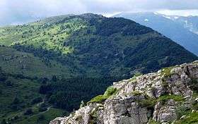 Monte Armetta from Monte Dubasso | |
| Highest point | |
| Elevation | 1,739 m (5,705 ft) [1] |
| Prominence | 805 [1][2] |
| Coordinates | 44°09′22″N 8°00′55″E / 44.15611°N 8.01528°ECoordinates: 44°09′22″N 8°00′55″E / 44.15611°N 8.01528°E |
| Naming | |
| Translation | Mountain of the small cave (Italian) |
| Geography | |
 Monte Armetta Location in the Alps | |
| Location | Liguria / Piedmont, Italy |
| Parent range | Ligurian Alps |
| Climbing | |
| First ascent | ancestral |
| Easiest route | hike |
Monte Armetta is a mountain in Piedmont, northern Italy, part of the Alps. At an altitude of 1,739 metres is the highest summit of the Ligurian Prealps.[3]
Etymology
According to the historian Emanuele Celesia the name Armetta comes from Hermes, but other scholars think that it's a diminutive of arma, a local term used in Liguria for cave.[4]
Geography
The mountain stands on the main chain of the Alps between Tanaro and Arroscia valleys. It belongs to the province of Cuneo, in Piedmont, and is located on the border between the municipalities of Ormea and Caprauna, not faraway from Liguria.[5]
SOIUSA classification
According to the SOIUSA (International Standardized Mountain Subdivision of the Alps) the mountain can be classified in the following way:[6]
- main part = Western Alps
- major sector = South Western Alps
- section = Ligurian Alps
- subsection = Prealpi Liguri
- supergroup = Catena Settepani-Carmo-Armetta
- group = Gruppo Galero-Armetta
- subgroup = Costiera Galero-Armetta
- code = I/A-1.I-A.3.a
Environment
The northern side of the mountain fells with overhanging cliffs towards Ormea, while its gentle southern slopes are covered of woods and pastures. On Monte Armetta, in spite of its not so high elevation, grow several typical mountain flowers as Leontopodium alpinum.[7]
Access to the summit
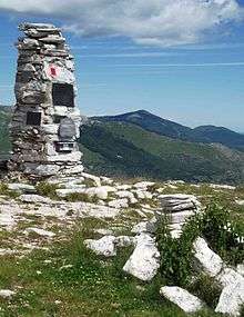
The mountain is accessible by off-road mountain paths and is crossed by the Alta Via dei Monti Liguri, a long-distance trail from Ventimiglia (province of Imperia) to Bolano (province of La Spezia).[8]
It's also possible to reach monte Armetta from Madonna del Lago sanctuary (located a couple of km from the centre of Alto) through a signposed foothpat which also crosses Monte Dubasso (1,545 m).[9]
References
- 1 2 "Monte Armetta, Italy". www.peakbagger.com. Retrieved 2016-01-19.
- ↑ Key Col: Colle di Nava, 934 m/3064 ft
- ↑ "1A1 Prealpi LIGURI". www.cailpv.bansel.it. Club Alpino Italiano of Liguria, Piedmont and Aosta Valley. Retrieved 2016-01-19.
- ↑ Atti della Società ligure di storia patria, volume 30, AA.VV., Società Ligure di Storia Patria, year 1900
- ↑ 1:25.000 map of Istituto Geografico Militare (IGM), on-line on www.pcn.minambiente.it
- ↑ Marazzi, Sergio (2005). Atlante Orografico delle Alpi. SOIUSA (in Italian). Priuli & Verlucca. ISBN 978-88-8068-273-8.
- ↑ Bollettino del Club Alpino Italiano: 1877-1896. Club Alpino Italiano. 1895. Retrieved 2016-01-19.
- ↑ "Alta via dei monti liguri - Melogno". www.altaviadeimontiliguri.it. Associazione Alta Via dei Monti Liguri. Archived from the original on 2016-01-25. Retrieved 2016-01-18.
- ↑ "Monte Dubasso e Monte Armetta mt. 1538- 1739". www.finoincima.altervista.org. Retrieved 2016-01-19.
![]()