Mont Saint-Grégoire
| Mont Saint-Grégoire | |
|---|---|
 Mont Saint-Grégoire | |
| Highest point | |
| Elevation | 251 m (823 ft) |
| Coordinates | 45°21′29″N 73°09′08″W / 45.35806°N 73.15222°WCoordinates: 45°21′29″N 73°09′08″W / 45.35806°N 73.15222°W |
| Geography | |
| Location | Mont-Saint-Grégoire, 10 km (6 mi) east of Saint-Jean-sur-Richelieu, Quebec, Canada |
| Parent range | Monteregian Hills |
| Topo map | NTS 031H/06 |
| Geology | |
| Age of rock | Early Cretaceous |
| Mountain type | Intrusive stock |
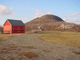
Mont Saint-Grégoire (height: 251 m (823 ft)) is a mountain in the Montérégie region of southern Quebec, Canada. It is composed of essexite and syenite, strongly contrasting with the surrounding sedimentary rocks. The area around Mont Saint-Grégoire is known for its maple syrup production, as well as some wine production.
The name was changed in 1923 from Mount Johnson .
Geology
It is thought that Mont Saint-Grégoire might be the deep extension of a vastly eroded ancient volcanic complex, which was probably active about 125 million years ago.[1] The mountain was created when the North American Plate moved westward over the New England hotspot,[1] along with the other mountains of the Monteregian Hills. It forms part of the vast Great Meteor hotspot track.
References
- 1 2 A Hundred-Million Year History of the Corner Rise and New England Seamounts Retrieved on 2007-08-01