Mont Jacques-Cartier
| Mont Jacques‑Cartier | |
|---|---|
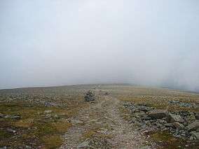 Trail leading to the summit of the mountain. | |
| Highest point | |
| Elevation | 1,268 m (4,160 ft) [1] |
| Prominence | 1085 |
| Listing | |
| Coordinates | 48°59′26″N 65°56′33″W / 48.99056°N 65.94250°WCoordinates: 48°59′26″N 65°56′33″W / 48.99056°N 65.94250°W [1] |
| Geography | |
 Mont Jacques‑Cartier Location in Quebec | |
| Location | Mont-Albert, Quebec, Canada |
| Parent range | Chic-Choc Mountains |
| Topo map | NTS 22A/13 |
| Climbing | |
| Easiest route | hiking |
Mont Jacques-Cartier is a mountain in the Chic-Choc Mountains range in eastern Quebec, Canada. At 1,268 m (4,160 ft), it is the tallest mountain in southern Quebec, and the highest mountain in the Canadian Appalachians.
Located in the Gaspé Peninsula, the mountain is protected by the Gaspésie National Park, and is host to the last remaining population of woodland caribou south of the Saint Lawrence River. The summit can be accessed by a hiking trail.
References
- 1 2 "Mont Jacques-Cartier". Bivouac.com. Retrieved 2009-03-18.
This article is issued from
Wikipedia.
The text is licensed under Creative Commons - Attribution - Sharealike.
Additional terms may apply for the media files.