Monroe Township, Pulaski County, Indiana
| Monroe Township | |
|---|---|
| Township | |
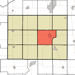 Location in Pulaski County | |
| Coordinates: 41°02′52″N 86°37′57″W / 41.04778°N 86.63250°WCoordinates: 41°02′52″N 86°37′57″W / 41.04778°N 86.63250°W | |
| Country |
|
| State |
|
| County | Pulaski |
| Government | |
| • Type | Indiana township |
| Area | |
| • Total | 41.3 sq mi (107 km2) |
| • Land | 40.95 sq mi (106.1 km2) |
| • Water | 0.35 sq mi (0.9 km2) 0.85% |
| Elevation | 709 ft (216 m) |
| Population (2010) | |
| • Total | 4,019 |
| • Density | 98.2/sq mi (37.9/km2) |
| ZIP codes | 46985, 46996 |
| GNIS feature ID | 453645 |
Monroe Township is one of twelve townships in Pulaski County, Indiana, United States. As of the 2010 census, its population was 4,019 and it contained 1,848 housing units.[1]
History
The Pulaski County Home was listed on the National Register of Historic Places in 2015.[2]
Geography
According to the 2010 census, the township has a total area of 41.3 square miles (107 km2), of which 40.95 square miles (106.1 km2) (or 99.15%) is land and 0.35 square miles (0.91 km2) (or 0.85%) is water.[1]
Cities, towns, villages
Adjacent townships
- Franklin Township (north)
- Tippecanoe Township (northeast)
- Harrison Township (east)
- Van Buren Township (southeast)
- Indian Creek Township (south)
- Beaver Township (southwest)
- Jefferson Township (west)
- Rich Grove Township (northwest)
Cemeteries
The township contains these four cemeteries: Crown Hill, Memorial Gardens, Reed and Saint Peters.
Major highways
Rivers
Education
- Eastern Pulaski Community School Corporation
Monroe Township residents may obtain a free library card from the Pulaski County Public Library in Winamac.[3]
Political districts
- Indiana's 2nd congressional district
- State House District 20
- State Senate District 18
References
- United States Census Bureau 2008 TIGER/Line Shapefiles
- United States Board on Geographic Names (GNIS)
- IndianaMap
- 1 2 "Population, Housing Units, Area, and Density: 2010 - County -- County Subdivision and Place -- 2010 Census Summary File 1". United States Census. Retrieved 2013-05-10.
- ↑ "National Register of Historic Places Listings". Weekly List of Actions Taken on Properties: 3/16/15 through 3/20/15. National Park Service. 2015-03-27.
- ↑ "The Library District". Pulaski County Public Library. Retrieved 14 March 2018.
External links
Places adjacent to Monroe Township, Pulaski County, Indiana | |
|---|---|
Municipalities and communities of Pulaski County, Indiana, United States | ||
|---|---|---|
| Towns | ||
| Townships | ||
| CDP | ||
| Other unincorporated communities | ||
This article is issued from
Wikipedia.
The text is licensed under Creative Commons - Attribution - Sharealike.
Additional terms may apply for the media files.