Monroe Township, Adams County, Ohio
| Monroe Township, Adams County, Ohio | |
|---|---|
| Township | |
 | |
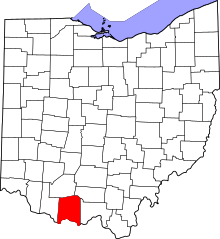
 Location in Adams County and the state of Ohio. | |
| Coordinates: 38°43′46″N 83°29′42″W / 38.72944°N 83.49500°WCoordinates: 38°43′46″N 83°29′42″W / 38.72944°N 83.49500°W | |
| Country | United States |
| State | Ohio |
| County | Adams |
| Area | |
| • Total | 28.1 sq mi (72.7 km2) |
| • Land | 27.2 sq mi (70.5 km2) |
| • Water | 0.9 sq mi (2.3 km2) |
| Elevation[1] | 942 ft (287 m) |
| Population (2010) | |
| • Total | 686 |
| • Density | 25/sq mi (9.7/km2) |
| Time zone | UTC-5 (Eastern (EST)) |
| • Summer (DST) | UTC-4 (EDT) |
| FIPS code | 39-51268[2] |
| GNIS feature ID | 1085682[1] |
Monroe Township is one of the fifteen townships of Adams County, Ohio, United States. As of the 2010 census the population was 686.[3]
Geography
Located in the southern part of the county along the Ohio River, it borders the following townships:
- Tiffin Township - north
- Brush Creek Township - northeast
- Green Township - east
- Manchester Township - southwest
- Sprigg Township - west
- Liberty Township - northwest
Lewis County, Kentucky lies across the Ohio River to the south.
No municipalities are located in Monroe Township.
History
Monroe Township was organized in 1817. It is named for James Monroe.[4]
It is one of twenty-two Monroe Townships statewide.[5]
Government
The township is governed by a three-member board of trustees, who are elected in November of odd-numbered years to a four-year term beginning on the following January 1. Two are elected in the year after the presidential election and one is elected in the year before it. There is also an elected township fiscal officer,[6] who serves a four-year term beginning on April 1 of the year after the election, which is held in November of the year before the presidential election. Vacancies in the fiscal officership or on the board of trustees are filled by the remaining trustees.
References
- 1 2 "US Board on Geographic Names". United States Geological Survey. 2007-10-25. Retrieved 2008-01-31.
- ↑ "American FactFinder". United States Census Bureau. Retrieved 2008-01-31.
- ↑ "Geographic Identifiers: 2010 Demographic Profile Data (G001): Monroe township, Adams County, Ohio". U.S. Census Bureau, American Factfinder. Retrieved July 5, 2013.
- ↑ Evans, Nelson Wiley (1900). A History of Adams County, Ohio: From Its Earliest Settlement to the Present Time. E B. Stivers. p. 449.
- ↑ "Detailed map of Ohio" (PDF). United States Census Bureau. 2000. Retrieved 2007-02-16.
- ↑ §503.24, §505.01, and §507.01 of the Ohio Revised Code. Accessed 4/30/2009.