Monforte d'Alba
| Monforte d'Alba | |
|---|---|
| Comune | |
| Comune di Monforte d'Alba | |
 | |
 Monforte d'Alba Location of Monforte d'Alba in Italy | |
| Coordinates: 44°35′N 7°58′E / 44.583°N 7.967°ECoordinates: 44°35′N 7°58′E / 44.583°N 7.967°E | |
| Country | Italy |
| Region | Piedmont |
| Province | Province of Cuneo (CN) |
| Area | |
| • Total | 25.7 km2 (9.9 sq mi) |
| Population (Dec. 2004) | |
| • Total | 1,976 |
| • Density | 77/km2 (200/sq mi) |
| Time zone | UTC+1 (CET) |
| • Summer (DST) | UTC+2 (CEST) |
| Postal code | 12065 |
| Dialing code | 0173 |
Monforte d'Alba is a comune (municipality) in the Province of Cuneo in the Italian region Piedmont, located about 60 kilometres (37 mi) southeast of Turin and about 40 kilometres (25 mi) northeast of Cuneo. As of 31 December 2004, it had a population of 1,976 and an area of 25.7 square kilometres (9.9 sq mi).[1]
Monforte d'Alba borders the following municipalities: Barolo, Castiglione Falletto, Dogliani, Monchiero, Novello, Roddino, and Serralunga d'Alba.
Monforte d'Alba is part of the zone of the noble Barolo wine production area.
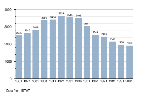
Demographic evolution
Gallery
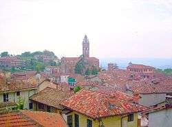
.jpg) A view of the town
A view of the town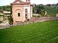 Amphitheater "Mieczyslaw Horszowski"
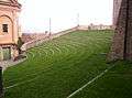 Another perspective of this natural amphitheater
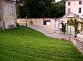 Another view
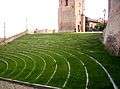
References

This article is issued from
Wikipedia.
The text is licensed under Creative Commons - Attribution - Sharealike.
Additional terms may apply for the media files.