Moncrieff, Australian Capital Territory
| Moncrieff Canberra, Australian Capital Territory | |||||||||||||||
|---|---|---|---|---|---|---|---|---|---|---|---|---|---|---|---|
 | |||||||||||||||
| Coordinates | 35°09′19″S 149°06′50″E / 35.15528°S 149.11389°ECoordinates: 35°09′19″S 149°06′50″E / 35.15528°S 149.11389°E | ||||||||||||||
| Population | 105 (2016 census)[1] | ||||||||||||||
| Established | 2014 | ||||||||||||||
| Postcode(s) | 2914 | ||||||||||||||
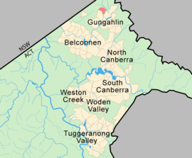
| District | Gungahlin | ||||||||||||||
| Territory electorate(s) | Yerrabi | ||||||||||||||
| Federal Division(s) | Fenner | ||||||||||||||
| |||||||||||||||
Moncrieff is a designated suburb in the Gungahlin district of Canberra, the National Capital of Australia. The name was gazetted in April 1991, with initial land releases becoming available to developers in June 2014.[2] It is named after Gladys Moncrieff, an Australian singer of the 1920-1930s musical era who was dubbed 'Australia's Queen of Song'. The suburb is located in north Gungahlin adjacent to the existing suburb of to the suburbs of Ngunnawal, Amaroo and the future suburbs of Taylor and Jacka. The suburb is located approximately 4 km from the Gungahlin Town Centre and 16 km from the centre of Canberra and is bounded by Mirrabei Drive and Horse Park Drive.
Future Development
When fully developed Moncrieff is expected to accommodate approximately 1800 dwellings.[3] and a variety in housing types including:
- Standard residential;
- medium and higher density residential (consistent with the provisions of Residential B8 and B9 Area Specific Policies of the Territory Plan) adjacent to the commercial centre, main community facility site and along Horse Park Drive;
- Compact block housing in the locations identified in the Compact Block Housing for New Estates; and
- “Affordable housing” in accordance with the Affordable Housing Action Plan.
A group shopping centre together with higher density housing is to be located near the intersection of Horse Park and Mirrabei Drives.[3]
Geography
With an area of approximately 200ha, of which only 130ha is developable, the suburb of Moncrieff is relatively small compared to other Gungahlin suburbs. Three hills dominate the area, the highest which is 674 meters above sea level. The green belt is characterised by Yellow Box-Red Gum Woodlands, lowland woodland and grasslands.[3]
Geology
The rock under Moncrieff consists of Canberra Formation of middle Silurian age. It consists of shale, slate, and mudstone.[4]
References
- ↑ Australian Bureau of Statistics (27 June 2017). "Moncrieff (State Suburb)". 2016 Census QuickStats. Retrieved 28 June 2017.

- ↑ "Moncrieff Land Sales". ACT Land Development Agency. Retrieved 21 May 2015.
- 1 2 3 ACT Planning and Land Authority (2008). "Moncrieff Concept Plan" (PDF). ACT Parliamentary Counsel.
- ↑ Henderson G A M and Matveev G, Geology of Canberra, Queanbeyan and Environs 1:50000 1980.