Monclova, Ohio
| Monclova, Ohio | |
|---|---|
| Unincorporated community | |
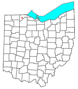 Location of Monclova, Ohio | |
| Coordinates: 41°33′31″N 83°43′59″W / 41.55861°N 83.73306°WCoordinates: 41°33′31″N 83°43′59″W / 41.55861°N 83.73306°W | |
| Country | United States |
| State | Ohio |
| County | Lucas |
| Township | Monclova |
| Time zone | UTC-5 (Eastern (EST)) |
| • Summer (DST) | UTC-4 (EDT) |
| ZIP codes | 43542 |
Monclova is an unincorporated community in central Monclova Township, Lucas County, Ohio, United States. Although it is unincorporated, it has a post office, with the ZIP code of 43542.[1]
History
Monclova was laid out in 1836.[2] A post office has been in operation at Monclova since 1852.[3]
References
- ↑ Zip Code Lookup
- ↑ Scribner, Harvey (1910). Memoirs of Lucas County and the City of Toledo: From the Earliest Historical Times Down to the Present, Including a Genealogical and Biographical Record of Representative Families. Western Historical Association. p. 198.
- ↑ "Lucas County". Jim Forte Postal History. Retrieved 21 January 2016.
Municipalities and communities of Lucas County, Ohio, United States | ||
|---|---|---|
| Cities | 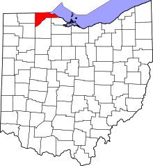 | |
| Villages | ||
| Townships | ||
| CDPs | ||
| Unincorporated communities |
| |
| Ghost towns | ||
| Footnotes | ‡This populated place also has portions in an adjacent county or counties | |
This article is issued from
Wikipedia.
The text is licensed under Creative Commons - Attribution - Sharealike.
Additional terms may apply for the media files.