Moei Wadi District
| Moei Wadi เมยวดี | |
|---|---|
| Amphoe | |
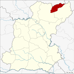 Amphoe location in Roi Et Province | |
| Coordinates: 16°23′21″N 104°9′27″E / 16.38917°N 104.15750°ECoordinates: 16°23′21″N 104°9′27″E / 16.38917°N 104.15750°E | |
| Country | Thailand |
| Province | Roi Et |
| Area | |
| • Total | 180.59 km2 (69.73 sq mi) |
| Population (2005) | |
| • Total | 22,463 |
| • Density | 124.4/km2 (322/sq mi) |
| Time zone | UTC+7 (ICT) |
| Postal code | 45250 |
| Geocode | 4515 |
Moei Wadi (Thai: เมยวดี, pronounced [mɤ̄ːj wā.dīː]) is a district (amphoe) in the northern part of Roi Et Province, northeastern Thailand.
Geography
Neighboring districts are (from the east clockwise) Nong Phok and Phon Thong of Roi Et Province, Kuchinarai of Kalasin Province and Nong Sung of Mukdahan Province.
History
The minor district (king amphoe) Moei Wadi was established on 1 April 1978, when the two tambon Moei Wadi and Chumphon were split off from Phon Thong District.[1] It was upgraded to a full district on 3 November 1993.[2]
Administration
The district is divided into four sub-districts (tambon), which are further subdivided into 43 villages (muban). There are no municipal (thesabans), and four tambon administrative organizations (TAO).
| No. | Name | Thai name | Villages | Pop. | |
|---|---|---|---|---|---|
| 1. | Moei Wadi | เมยวดี | 11 | 5,609 | |
| 2. | Chumphon | ชุมพร | 14 | 7,823 | |
| 3. | Bung Loet | บุ่งเลิศ | 9 | 4,852 | |
| 4. | Chom Sa-at | ชมสะอาด | 9 | 4,179 |
References
- ↑ ประกาศกระทรวงมหาดไทย เรื่อง แบ่งท้องที่อำเภอโพนทอง จังหวัดร้อยเอ็ด ตั้งเป็นกิ่งอำเภอเมยวดี (PDF). Royal Gazette (in Thai). 95 (42 ง): 1124. April 18, 1978.
- ↑ พระราชกฤษฎีกาตั้งอำเภอลำทับ อำเภอร่องคำ อำเภอเวียงแหง อำเภอนาโยง อำเภอแก้งสนามนาง อำเภอโนนแดง อำเภอบ้านหลวง อำเภอกะพ้อ อำเภอศรีบรรพต อำเภอแก่งกระจาน อำเภอหนองสูง อำเภอสบเมย อำเภอเมยวดี อำเภอโคกเจริญ อำเภอทุ่งหัวช้าง อำเภอผาขาว อำเภอวังหิน อำเภอดอนพุด อำเภอบึงโขงหลง และอำเภอห้วยคต พ.ศ. ๒๕๓๖ (PDF). Royal Gazette (in Thai). 110 (179 ก special): 1–3. November 3, 1993.
External links
- amphoe.com (Thai)
This article is issued from
Wikipedia.
The text is licensed under Creative Commons - Attribution - Sharealike.
Additional terms may apply for the media files.