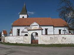
Modrá Hůrka
| Modrá Hůrka | |
|---|---|
| Municipality | |
 | |
 Modrá Hůrka | |
| Coordinates: 49°10′49″N 14°31′34″E / 49.18028°N 14.52611°ECoordinates: 49°10′49″N 14°31′34″E / 49.18028°N 14.52611°E | |
| Country |
|
| Region | South Bohemian |
| District | České Budějovice |
| Area | |
| • Total | 3.95 km2 (1.53 sq mi) |
| Elevation | 513 m (1,683 ft) |
| Population (2006) | |
| • Total | 74 |
| • Density | 19/km2 (49/sq mi) |
| Postal code | 373 66 |
Modrá Hůrka is a village and municipality (obec) in České Budějovice District in the South Bohemian Region of the Czech Republic.
The municipality covers an area of 3.95 square kilometres (1.53 sq mi), and has a population of 74 (as at 3 July 2006).
Modrá Hůrka lies approximately 24 kilometres (15 mi) north of České Budějovice and 101 km (63 mi) south of Prague.
References
| Wikimedia Commons has media related to Modrá Hůrka. |
This article is issued from
Wikipedia.
The text is licensed under Creative Commons - Attribution - Sharealike.
Additional terms may apply for the media files.