Mocho-Choshuenco National Reserve
| Mocho-Choshuenco National Reserve | |
|---|---|
|
IUCN category IV (habitat/species management area) | |
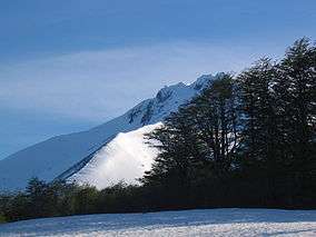 A view of the Choshuenco volcano in early November from the former ski pistes | |
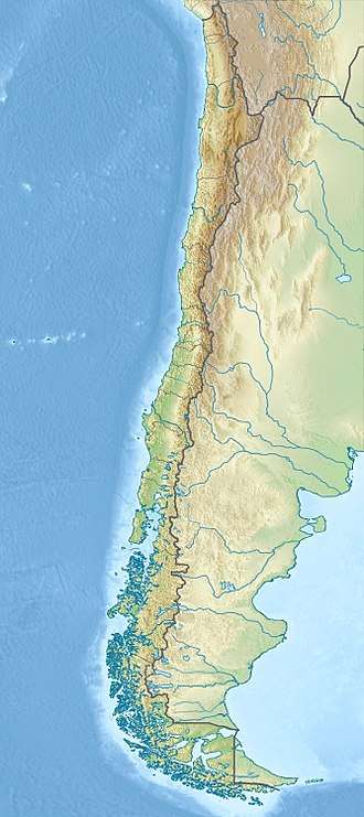 The white dot is the location of Valdivia | |
| Location | Los Ríos Region, Chile |
| Nearest city | Panguipulli |
| Coordinates | 39°55′52″S 72°03′40″W / 39.931°S 72.061°WCoordinates: 39°55′52″S 72°03′40″W / 39.931°S 72.061°W[1] |
| Area | 7,537 ha (18,620 acres) |
| Established | 1994 |
| Governing body | Corporación Nacional Forestal |
The Mocho-Choshuenco National Reserve (Pronounced: /ˌmɒtʃoʊ
Mocho-Choshuenco National Reserve has no park guards or any public infrastructure. In the refuge sector there is a mountain hut leased to Los Lagos municipality, some old military buildings ruins, and the rests of a small ski centre.
Gallery
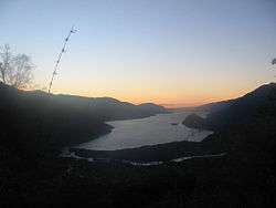 Sunset on Riñihue Lake, view from Mocho-Choshuenco
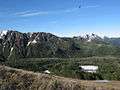 Río Blanco Valley. Río Blanco river drains the west side of Mocho-Choshuenco to the Enco River.
References
- ↑ "Mocho-Choshuenco National Reserve". protectedplanet.net.
External links
- (in Spanish) A specialized blog about Mocho-Choshuenco National Reserve at mochochoshuenco.blogspot.com