Altos de Lircay National Reserve
| Altos de Lircay National Reserve | |
|---|---|
|
IUCN category IV (habitat/species management area) | |
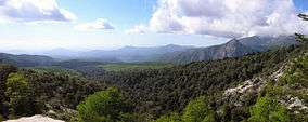 Panoramic | |
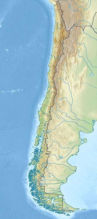 Map of Chile | |
| Location | Talca Province, Maule Region, Chile |
| Nearest city | San Clemente |
| Coordinates | 35°35′24″S 70°56′13″W / 35.59°S 70.937°WCoordinates: 35°35′24″S 70°56′13″W / 35.59°S 70.937°W[1] |
| Area | 121.63 km2 (46.96 sq mi) |
| Established | 1996 |
| Governing body | Corporación Nacional Forestal |
Altos de Lircay National Reserve is a 121.63 km2 (46.96 sq mi)[1] nature reserve located in Talca Province, Maule Region, Chile. It lies in a pre-Andean area close to Radal Siete Tazas National Park, as well as Descabezado Grande and Cerro Azul volcanoes.
The reserve is home to a significant variety of wildlife including rare and threatened animals such as the Tricahue parrot,[2] Molina's hog-nosed skunk and plants such as the ciprés de la cordillera and roble Maulino. In the area can be found seven of the ten species of the genus Nothofagus occurring in Chile.
There are three major rivers in the reserve, the Lircay that is a tributary of the Claro River, the Claro that flows north to south through the reserve, and the Blanquillo that joins the latter river in the reserve.[3]
References
- 1 2 "Altos Del Lircay National Reserve". protectedplanet.net. Archived from the original on 2012-06-16. Retrieved 2011-12-29.
- ↑ http://www.turismovillarrica.cl/english/birds.html#loro
- ↑ "Reserva Nacional Altos de Lircay" (in Spanish). CONAF. Archived from the original on 2012-07-22. Retrieved August 14, 2012.