Mladý Smolivec
| Mladý Smolivec | |
|---|---|
| Municipality | |
 Mladý Smolivec | |
| Coordinates: 49°30′30″N 13°44′23″E / 49.50833°N 13.73972°ECoordinates: 49°30′30″N 13°44′23″E / 49.50833°N 13.73972°E | |
| Country |
|
| Region | Plzeň |
| District | Plzeň-South |
| Area | |
| • Total | 30.39 km2 (11.73 sq mi) |
| Elevation | 514 m (1,686 ft) |
| Population (2006) | |
| • Total | 721 |
| • Density | 24/km2 (61/sq mi) |
| Postal code | 332 04 to 335 43 |
| Website | http://www.mladysmolivec.cz |
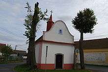
Chapel
Mladý Smolivec is a village and municipality (obec) in Plzeň-South District in the Plzeň Region of the Czech Republic.
The municipality covers an area of 30.39 square kilometres (11.73 sq mi), and has a population of 721 (as at 28 August 2006).
Mladý Smolivec lies approximately 38 kilometres (24 mi) south-east of Plzeň and 81 km (50 mi) south-west of Prague.
References
| Wikimedia Commons has media related to Mladý Smolivec. |
This article is issued from
Wikipedia.
The text is licensed under Creative Commons - Attribution - Sharealike.
Additional terms may apply for the media files.