Misgar, Gojal
| Misgar | |
|---|---|
| Village / Valley | |
 | |
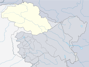 Misgar Location in Pakistan  Misgar Misgar (Pakistan) | |
| Coordinates: 36°47′15″N 74°46′00″E / 36.7875°N 74.7667°ECoordinates: 36°47′15″N 74°46′00″E / 36.7875°N 74.7667°E | |
| Country |
|
| Autonomous state | G-B |
| District | Gilgit District |
| Population | |
| • Total | 1,227[1] |
| Languages | |
| • Local | Burushaski[1] |
| Time zone | PST |
Misgar (Urdu: مسگر) is a village and valley situated in the northern end of Pakistan. It is on the edge of Hunza District in Gilgit-Baltistan where Pakistan border China and Afghanistan. In recent years, it is also the base for an easy and fascinating trek to Kilik Pass and Mintaka Pass, two Silk Road passes to Tarim Basin in China.
History
Kilik Pass and Mintaka Pass north of the town are part of the ancient Silk Road. They were the usual caravan route from Pakistan and India to Tashkurgan before the opening of the Karakoram Highway.[2]
The current settlements of Misgar in Misgar valley was established since at least 1844.[1] Around that time it was settled by people from four tribes who came from Hunza.[3]
British Raj took control of the area in 1892 as part of their efforts during the Great Game.[1] It remained part of Hunza until independence of Pakistan in 1947.[3]


References
- 1 2 3 4 "Misgar - Trekking along the Ancient Silk Route" (PDF). Mountain Area Conservancy Project. Retrieved 2017-06-17.
- ↑ Hill, John E. (September 2003). "Section 20 The Kingdom of Suoche 莎車 (Yarkand).". The Western Regions according to the Hou Hanshu. University of Washington. Retrieved 2017-02-07.
- 1 2 Mir Aman Hunzai (2015-03-05). "Misgar valley wildlife". Dawn.com. Retrieved 2017-06-17.
External links
![]()