Mineral Bluff, Georgia
| Mineral Bluff, Georgia | |
|---|---|
| Census-designated place | |
 Church in Mineral Bluff | |
 Mineral Bluff | |
| Coordinates: 34°54′52″N 84°16′36″W / 34.91444°N 84.27667°WCoordinates: 34°54′52″N 84°16′36″W / 34.91444°N 84.27667°W | |
| Country | United States |
| State | Georgia |
| County | Fannin |
| Area[1] | |
| • Total | 1.377 sq mi (3.57 km2) |
| • Land | 1.373 sq mi (3.56 km2) |
| • Water | 0.004 sq mi (0.01 km2) |
| Elevation | 1,572 ft (479 m) |
| Population (2010)[2] | |
| • Total | 150 |
| • Density | 110/sq mi (42/km2) |
| Time zone | UTC-5 (Eastern (EST)) |
| • Summer (DST) | UTC-4 (EDT) |
| ZIP code | 30559[3] |
| Area code(s) | 706/762 |
| GNIS feature ID | 332400[4] |
Mineral Bluff is a census-designated place and unincorporated community located in Fannin County in the U.S. state of Georgia.[4] Its population was 150 as of the 2010 census.[2] The community is situated 6 miles (10 km) northeast of the city of Blue Ridge, the county seat, 80 miles (130 km) east of Chattanooga, Tennessee, and 100 miles (160 km) north of Atlanta.[5] It is the location of Mineral Bluff Depot,[6] listed on the National Register of Historic Places.
References
- ↑ "US Gazetteer files: 2010, 2000, and 1990". United States Census Bureau. 2011-02-12. Retrieved 2011-04-23.
- 1 2 "American FactFinder". United States Census Bureau. Retrieved 2011-05-14.
- ↑ United States Postal Service (2012). "USPS - Look Up a ZIP Code". Retrieved 2012-02-15.
- 1 2 "Mineral Bluff". Geographic Names Information System. United States Geological Survey.
- ↑ Google Maps: road distances
- ↑ RailGA - Georgia's Railroad History & Heritage
| Wikimedia Commons has media related to Mineral Bluff, Georgia. |
| Wikivoyage has a travel guide for Mineral Bluff. |
Municipalities and communities of Fannin County, Georgia, United States | ||
|---|---|---|
| Cities | 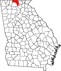 | |
| CDPs | ||
| Unincorporated communities | ||
| Ghost towns | ||
This article is issued from
Wikipedia.
The text is licensed under Creative Commons - Attribution - Sharealike.
Additional terms may apply for the media files.