Blue Ridge, Georgia
| Blue Ridge, Georgia | |
|---|---|
| City | |
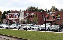 Downtown Blue Ridge | |
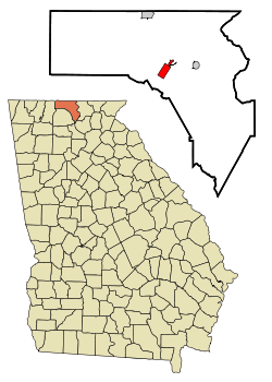 Location in Fannin County and the state of Georgia | |
| Coordinates: 34°52′6″N 84°19′16″W / 34.86833°N 84.32111°WCoordinates: 34°52′6″N 84°19′16″W / 34.86833°N 84.32111°W | |
| Country | United States |
| State | Georgia |
| County | Fannin |
| Area | |
| • Total | 2.4 sq mi (6.2 km2) |
| • Land | 2.4 sq mi (6.2 km2) |
| • Water | 0 sq mi (0 km2) |
| Elevation | 1,762 ft (537 m) |
| Population (2010) | |
| • Total | 1,290 |
| • Estimate (2016)[1] | 1,391 |
| • Density | 542/sq mi (209.2/km2) |
| Time zone | UTC-5 (Eastern (EST)) |
| • Summer (DST) | UTC-4 (EDT) |
| ZIP code | 30513 |
| Area code(s) | 706/762 |
| FIPS code | 13-08928[2] |
| GNIS feature ID | 0331197[3] |
| Website |
www |
Blue Ridge is a city in Fannin County, Georgia, United States. As of the 2010 census, the city had a population of 1,290.[4] The city is the county seat of Fannin County.[5]
History
Blue Ridge was laid out in 1886 when the Marietta and North Georgia Railroad was extended to that point.[6] It was incorporated in 1887.[7] In 1895, the seat of Fannin County was transferred to Blue Ridge from Morganton.[8]
In the late 2000s and continuing through the 2010s, the city has seen a surge in new business, particularly from the LGBT community which constitutes a larger percentage of the population than is typical for a rural community.[9]
Geography
The city of Blue Ridge is located south of the center of Fannin County at 34°52′6″N 84°19′16″W / 34.86833°N 84.32111°W (34.868344, -84.320991).[10] The city sits on the divide between the Tennessee River watershed to the north (via the Toccoa River) and the Alabama River to the south (via Crooked Log Creek, the Ellijay River, and several downstream rivers).
U.S. Route 76 passes through the west side of the city, leading east 22 miles (35 km) to Blairsville and southwest 15 miles (24 km) to Ellijay. Georgia State Route 5 leads north from Blue Ridge 10 miles (16 km) to McCaysville at the Tennessee line.
According to the United States Census Bureau, the city has a total area of 2.4 square miles (6.2 km2), all land.[11]
Climate
| Climate data for Blue Ridge, Georgia | |||||||||||||
|---|---|---|---|---|---|---|---|---|---|---|---|---|---|
| Month | Jan | Feb | Mar | Apr | May | Jun | Jul | Aug | Sep | Oct | Nov | Dec | Year |
| Record high °F (°C) | 74 (23) |
78 (26) |
85 (29) |
91 (33) |
94 (34) |
100 (38) |
103 (39) |
101 (38) |
98 (37) |
92 (33) |
83 (28) |
76 (24) |
103 (39) |
| Average high °F (°C) | 50 (10) |
54 (12) |
61 (16) |
71 (22) |
78 (26) |
84 (29) |
88 (31) |
87 (31) |
81 (27) |
72 (22) |
62 (17) |
52 (11) |
70 (21) |
| Daily mean °F (°C) | 38 (3) |
41 (5) |
48 (9) |
56 (13) |
64 (18) |
71 (22) |
76 (24) |
75 (24) |
68 (20) |
57 (14) |
48 (9) |
40 (4) |
57 (14) |
| Average low °F (°C) | 26 (−3) |
28 (−2) |
34 (1) |
40 (4) |
49 (9) |
58 (14) |
63 (17) |
62 (17) |
54 (12) |
42 (6) |
34 (1) |
28 (−2) |
43 (6) |
| Record low °F (°C) | −16 (−27) |
−5 (−21) |
2 (−17) |
17 (−8) |
29 (−2) |
37 (3) |
47 (8) |
46 (8) |
30 (−1) |
19 (−7) |
−1 (−18) |
−8 (−22) |
−16 (−27) |
| Average precipitation inches (mm) | 5.8 (147) |
5.5 (140) |
6.4 (163) |
4.9 (124) |
5.0 (127) |
4.6 (117) |
5.4 (137) |
4.8 (122) |
4.5 (114) |
3.3 (84) |
5.0 (127) |
5.0 (127) |
60.2 (1,529) |
| Source: [12] | |||||||||||||
Demographics
| Historical population | |||
|---|---|---|---|
| Census | Pop. | %± | |
| 1890 | 264 | — | |
| 1900 | 1,148 | 334.8% | |
| 1910 | 898 | −21.8% | |
| 1920 | 904 | 0.7% | |
| 1930 | 1,190 | 31.6% | |
| 1940 | 1,362 | 14.5% | |
| 1950 | 1,718 | 26.1% | |
| 1960 | 1,406 | −18.2% | |
| 1970 | 1,602 | 13.9% | |
| 1980 | 1,376 | −14.1% | |
| 1990 | 1,336 | −2.9% | |
| 2000 | 1,210 | −9.4% | |
| 2010 | 1,290 | 6.6% | |
| Est. 2016 | 1,391 | [1] | 7.8% |
| U.S. Decennial Census[13] | |||
As of the 2010 United States Census, there were 1,290 people residing in the city. The racial makeup of the city was 92.1% White, 1.2% Black, 0.2% Native American, 0.5% Asian, 0.7% from some other race and 0.9% from two or more races. 4.5% were Hispanic or Latino of any race.
As of the census[2] of 2000, there were 1,210 people, 553 households, and 319 families residing in the city. The population density was 557.2 people per square mile (215.3/km2). There were 631 housing units at an average density of 290.6 per square mile (112.3/km2). The racial makeup of the city was 98.26% White, 0.41% African American, 0.41% Asian, 0.17% from other races, and 0.74% from two or more races. Hispanic or Latino of any race were 0.83% of the population.
There were 553 households out of which 25.1% had children under the age of 18 living with them, 38.9% were married couples living together, 15.9% had a female householder with no husband present, and 42.3% were non-families. 38.2% of all households were made up of individuals and 19.7% had someone living alone who was 65 years of age or older. The average household size was 2.14 and the average family size was 2.81.
In the city, the population was spread out with 22.3% under the age of 18, 9.8% from 18 to 24, 23.9% from 25 to 44, 25.2% from 45 to 64, and 18.8% who were 65 years of age or older. The median age was 39 years. For every 100 females, there were 83.3 males. For every 100 females age 18 and over, there were 80.8 males.
The median income for a household in the city was $28,214, and the median income for a family was $35,259. Males had a median income of $25,859 versus $17,941 for females.
The per capita income for the city was $16,149. About 13.7% of families and 17.0% of the population were below the poverty line, including 22.9% of those under age 18 and 16.6% of those age 65 or over.
Education
Fannin County School District
The Fannin County School District holds pre-school to grade twelve, and consists of three elementary schools, a middle school, and a high school.[14] The district has 179 full-time teachers and more than 3,212 students.[15]
- Blue Ridge Elementary School
- East Fannin Elementary School
- West Fannin Elementary School
- Fannin County Middle School
- Fannin County High School
Cinema
The town has one of the few drive-in theaters in North Georgia, the Swan.
Notable people
- Lake Underwood, entrepreneur, inventor, and racecar owner and driver
- Mark Wills, country singer
References
- 1 2 "Population and Housing Unit Estimates". Retrieved June 9, 2017.
- 1 2 "American FactFinder". United States Census Bureau. Archived from the original on 2013-09-11. Retrieved 2008-01-31.
- ↑ "US Board on Geographic Names". United States Geological Survey. 2007-10-25. Retrieved 2008-01-31.
- ↑ http://factfinder2.census.gov/faces/tableservices/jsf/pages/productview.xhtml?pid=DEC_10_SF1_GCTP2.ST13&prodType=table
- ↑ "Find a County". National Association of Counties. Archived from the original on 2011-05-31. Retrieved 2011-06-07.
- ↑ "History". Town of Blue Ridge. Retrieved 2 April 2018.
- ↑ Krakow, Kenneth K. (1975). Georgia Place-Names: Their History and Origins (PDF). Macon, GA: Winship Press. p. 21. ISBN 0-915430-00-2.
- ↑ Hellmann, Paul T. (May 13, 2013). "Historical Gazetteer of the United States". Routledge. p. 221. Retrieved 30 November 2013.
- ↑ "Why this Georgia town has become a gay-friendly hot spot". The Atlanta Journal-Constitution.
- ↑ "US Gazetteer files: 2010, 2000, and 1990". United States Census Bureau. 2011-02-12. Retrieved 2011-04-23.
- ↑ "Geographic Identifiers: 2010 Census Summary File 1 (G001), Blue Ridge city, Georgia". American FactFinder. U.S. Census Bureau. Retrieved April 26, 2016.
- ↑ "Average Monthly/Record Temperatures". The Weather Channel. Retrieved 6 September 2015.
- ↑ "Census of Population and Housing". Census.gov. Archived from the original on May 12, 2015. Retrieved June 4, 2015.
- ↑ Georgia Board of Education, Retrieved June 9, 2010.
- ↑ School Stats, Retrieved June 9, 2010.
External links
| Wikivoyage has a travel guide for Blue Ridge (Georgia). |
- City of Blue Ridge official website
- Fannin County Chamber of Commerce
- The News Observer
- Blue Ridge Scenic Railway
Municipalities and communities of Fannin County, Georgia, United States | ||
|---|---|---|
| Cities | 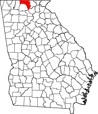 | |
| CDPs | ||
| Unincorporated communities | ||
| Ghost towns | ||