Mindoro, Wisconsin
| Mindoro, Wisconsin | |
|---|---|
| Unincorporated community | |
 Mindoro, Wisconsin  Mindoro, Wisconsin | |
| Coordinates: 44°01′16″N 91°06′07″W / 44.02111°N 91.10194°W | |
| Country | United States |
| State | Wisconsin |
| County | La Crosse |
| Elevation | 787 ft (240 m) |
| Time zone | UTC-6 (Central (CST)) |
| • Summer (DST) | UTC-5 (CDT) |
| Area code(s) | 608 |
| GNIS feature ID | 1569547[1] |
Mindoro is an unincorporated community in La Crosse County, Wisconsin, United States, in the town of Farmington.[1] It is part of the La Crosse, Wisconsin Metropolitan Statistical Area.[2]
Landmarks
The Mindoro Cut is located near Mindoro, on Wisconsin Highway 108.
Mindoro is also home to the Bell Coulee Shelter, a rock shelter that was home to an ancient people.
Notable people
- Stanley R. Christianson, who posthumously was awarded the Medal of Honor for his role during the Korean War, was born in Mindoro.
- Virgil Roberts, member of the Wisconsin State Assembly, was born in Mindoro.
Notes
Municipalities and communities of La Crosse County, Wisconsin, United States | ||
|---|---|---|
| Cities | 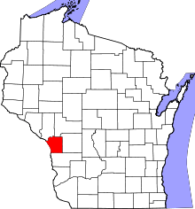 | |
| Villages | ||
| Towns | ||
| CDPs | ||
| Unincorporated communities | ||
| Indian reservation | ||
| Footnotes | ‡This populated place also has portions in an adjacent county or counties | |
Coordinates: 44°01′16″N 91°06′07″W / 44.02111°N 91.10194°W
This article is issued from
Wikipedia.
The text is licensed under Creative Commons - Attribution - Sharealike.
Additional terms may apply for the media files.