Milton Hill Historic District
|
Milton Hill Historic District | |
 | |
  | |
| Location | Roughly bounded by Adams and School Sts., Randolph and Canton Aves. and Brook Rd., Milton, Massachusetts |
|---|---|
| Coordinates | 42°15′52″N 71°3′59″W / 42.26444°N 71.06639°WCoordinates: 42°15′52″N 71°3′59″W / 42.26444°N 71.06639°W |
| Area | 220.4 acres (89.2 ha) |
| Architect | Cram and Ferguson; et al. |
| Architectural style | Mid 19th Century Revival, Early Republic, Colonial |
| NRHP reference # | 95000698[1] |
| Added to NRHP | June 09, 1995 |
The Milton Hill Historic District is a historic district in Milton, Massachusetts. It was listed on the National Register of Historic Places in 1995.[1]
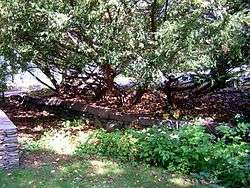
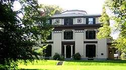
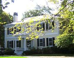
The Milton Hill area first became prominent in the 1740s as the estate of Thomas Hutchinson, a prominent politician whose actions as Acting Governor and Governor of the Province of Massachusetts Bay heightened tensions leading to the American Revolutionary War. He left the province in 1774, and his estate was eventually confiscated by the state. It has since then been a fashionable residential area of the town. It includes the Captain Robert Bennet Forbes House, a National Historic Landmark, as well as the Dr. Amos Holbrook House and Governor Hutchinson's Ha-ha, both separately listed on the National Register of Historic Places.[2]
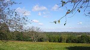
Governor Thomas Hutchinson's Field, owned by The Trustees of the Reservations, lies in the middle of the district and offers sweeping views of Boston and the South Shore.[2]
Gallery
See also
References
- 1 2 National Park Service (2009-03-13). "National Register Information System". National Register of Historic Places. National Park Service.
- 1 2 "NRHP nomination for Milton Hill Historic District". Commonwealth of Massachusetts. Retrieved 2014-05-25.
| Topics |  | ||||||||||||||||
|---|---|---|---|---|---|---|---|---|---|---|---|---|---|---|---|---|---|
| Lists by county | |||||||||||||||||
| Lists by city |
| ||||||||||||||||
| Other lists | |||||||||||||||||
| |||||||||||||||||