Millston (CDP), Wisconsin
| Millston, Wisconsin | |
|---|---|
| Census-designated place | |
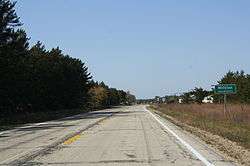 Sign for Millston on US 12 | |
 Millston, Wisconsin | |
| Coordinates: 44°11′35″N 90°38′51″W / 44.19306°N 90.64750°WCoordinates: 44°11′35″N 90°38′51″W / 44.19306°N 90.64750°W | |
| Country | United States |
| State | Wisconsin |
| County | Jackson |
| Area | |
| • Total | 1.102 sq mi (2.85 km2) |
| • Land | 1.041 sq mi (2.70 km2) |
| • Water | 0.061 sq mi (0.16 km2) |
| Elevation | 912 ft (278 m) |
| Population (2010) | |
| • Total | 125 |
| • Density | 110/sq mi (44/km2) |
| Time zone | UTC-6 (Central (CST)) |
| • Summer (DST) | UTC-5 (CDT) |
| Area code(s) | 715 & 534 |
| GNIS feature ID | 1569526[1] |
Millston is an unincorporated census-designated place located in the town of Millston, Jackson County, Wisconsin, United States. Millston is located along U.S. Route 12 and Interstate 94 12.5 miles (20.1 km) southeast of Black River Falls.[2] As of the 2010 census, its population is 125.[3] Millston is completely surrounded by the Black River State Forest.
History
Millston was founded in 1870 by H. B. Mills, and named for him.[4] A post office called Millston has been in operation since 1874.[5]
Images
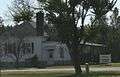 Millston Community Center
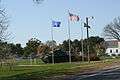 Millston Memorial Park
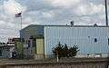 Post office
References
- ↑ U.S. Geological Survey Geographic Names Information System: Millston (CDP), Wisconsin
- ↑ Jackson County (PDF) (Map). Wisconsin Department of Transportation. Archived from the original (PDF) on July 21, 2011. Retrieved 2011-02-16.
- ↑ "American FactFinder". U.S. Census Bureau. Retrieved April 15, 2011.
- ↑ Chicago and North Western Railway Company (1908). A History of the Origin of the Place Names Connected with the Chicago & North Western and Chicago, St. Paul, Minneapolis & Omaha Railways. p. 184.
- ↑ "Jackson County". Jim Forte Postal History. Retrieved 4 April 2015.
Municipalities and communities of Jackson County, Wisconsin, United States | ||
|---|---|---|
| City | 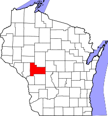 | |
| Villages | ||
| Towns | ||
| CDPs | ||
| Unincorporated communities | ||
| Ghost towns/neighborhoods | ||
| Indian reservation | ||
| Footnotes | ‡This populated place also has portions in an adjacent county or counties | |
This article is issued from
Wikipedia.
The text is licensed under Creative Commons - Attribution - Sharealike.
Additional terms may apply for the media files.