Millegin railway station
| Millegin | |
|---|---|
| Millagan | |
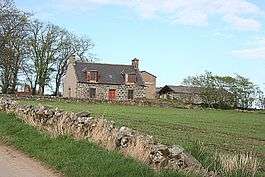 Millegin near Bridge of Millegin | |
| Location | |
| Place | Banff, Aberdeenshire |
| Area | Aberdeenshire |
| Coordinates | 57°32′44″N 2°48′33″W / 57.545593°N 2.809213°WCoordinates: 57°32′44″N 2°48′33″W / 57.545593°N 2.809213°W |
| Grid reference | NJ 516 508 |
| Operations | |
| Original company | Banff, Portsoy and Strathisla Railway |
| Pre-grouping | Great North of Scotland Railway |
| Platforms | 1 |
| History | |
| 30 July 1859[1] | Opened |
| October 1860[1] | Closed to passengers |
| Disused railway stations in the United Kingdom | |
|
Closed railway stations in Britain A B C D–F G H–J K–L M–O P–R S T–V W–Z | |
|
| |
Millegin railway station, Millagan railway station[1] or later Millegin Siding[2] was briefly an intermediate stop situated[3] on what became the Great North of Scotland Railway (GNoSR) line from Grange and Cairnie Junction to Tillynaught. Millegin served the rural community and the nearby saw mill in Banffshire. The line northwards ran to Tillynaught where it split to reach Banff by a branch line or Elgin by the Moray Coast line.
Millegin was opened in 1859 by the Banff, Portsoy and Strathisla Railway,[4] and closed to passengers in October 1860, remaining as a freight siding that was however lifted by 1902.[5] The line passed into British Railways ownership in 1948 and was, like the rest of the ex-GNoSR lines along the Moray coast, considered for closure as part of the Beeching report, closure notices were issued in 1963. [6]
Station infrastructure
In 1867 the OS map shows that the station had closed and only a siding was present with a loading dock,[7][8] by 1902 the siding had been lifted.[9]
No physical remains of the station or siding are visible on site.[10]
| Preceding station | Historical railways | Following station | ||
|---|---|---|---|---|
| Grange Towards Grange |
Great North of Scotland Banff branch |
Knock Towards Banff | ||
| Banff, Portsoy and Strathisla Railway | |||||||||||||||||||||||||||||||||||||||||||||||||||||||||||||||||||||||||||||||||||||||||||||||||||||||||||||||||||||||||||||||||||||||||||||||||||||||||||||||
|---|---|---|---|---|---|---|---|---|---|---|---|---|---|---|---|---|---|---|---|---|---|---|---|---|---|---|---|---|---|---|---|---|---|---|---|---|---|---|---|---|---|---|---|---|---|---|---|---|---|---|---|---|---|---|---|---|---|---|---|---|---|---|---|---|---|---|---|---|---|---|---|---|---|---|---|---|---|---|---|---|---|---|---|---|---|---|---|---|---|---|---|---|---|---|---|---|---|---|---|---|---|---|---|---|---|---|---|---|---|---|---|---|---|---|---|---|---|---|---|---|---|---|---|---|---|---|---|---|---|---|---|---|---|---|---|---|---|---|---|---|---|---|---|---|---|---|---|---|---|---|---|---|---|---|---|---|---|---|---|
| Overview | |||||||||||||||||||||||||||||||||||||||||||||||||||||||||||||||||||||||||||||||||||||||||||||||||||||||||||||||||||||||||||||||||||||||||||||||||||||||||||||||
| Locale | Scotland | ||||||||||||||||||||||||||||||||||||||||||||||||||||||||||||||||||||||||||||||||||||||||||||||||||||||||||||||||||||||||||||||||||||||||||||||||||||||||||||||
| Operation | |||||||||||||||||||||||||||||||||||||||||||||||||||||||||||||||||||||||||||||||||||||||||||||||||||||||||||||||||||||||||||||||||||||||||||||||||||||||||||||||
| Opened | 1859 | ||||||||||||||||||||||||||||||||||||||||||||||||||||||||||||||||||||||||||||||||||||||||||||||||||||||||||||||||||||||||||||||||||||||||||||||||||||||||||||||
| Closed | 1968 | ||||||||||||||||||||||||||||||||||||||||||||||||||||||||||||||||||||||||||||||||||||||||||||||||||||||||||||||||||||||||||||||||||||||||||||||||||||||||||||||
| Events | |||||||||||||||||||||||||||||||||||||||||||||||||||||||||||||||||||||||||||||||||||||||||||||||||||||||||||||||||||||||||||||||||||||||||||||||||||||||||||||||
| Successor line | Great North of Scotland Railway | ||||||||||||||||||||||||||||||||||||||||||||||||||||||||||||||||||||||||||||||||||||||||||||||||||||||||||||||||||||||||||||||||||||||||||||||||||||||||||||||
| Technical | |||||||||||||||||||||||||||||||||||||||||||||||||||||||||||||||||||||||||||||||||||||||||||||||||||||||||||||||||||||||||||||||||||||||||||||||||||||||||||||||
| Line length | 19 1⁄2 miles (31.4 km) | ||||||||||||||||||||||||||||||||||||||||||||||||||||||||||||||||||||||||||||||||||||||||||||||||||||||||||||||||||||||||||||||||||||||||||||||||||||||||||||||
| Track gauge | 4 ft 8 1⁄2 in (1,435 mm) | ||||||||||||||||||||||||||||||||||||||||||||||||||||||||||||||||||||||||||||||||||||||||||||||||||||||||||||||||||||||||||||||||||||||||||||||||||||||||||||||
| |||||||||||||||||||||||||||||||||||||||||||||||||||||||||||||||||||||||||||||||||||||||||||||||||||||||||||||||||||||||||||||||||||||||||||||||||||||||||||||||
See also
References
- Notes
- 1 2 3 Butt (1995), p. 160.
- ↑ Banffshire, Sheet XV (includes: Fordyce; Grange; Marnoch; Ordiquhill; Rothiemay). Survey date: 1867. Publication date: 1871.
- ↑ Butt (1995), p. 137.
- ↑ Butt 1995, p. 28.
- ↑ Banffshire Sheet XV.SW (includes: Grange; Rothiemay). Publication date: 1905. Date revised: 1902
- ↑ Maxtone (2005), p. 55.
- ↑ Scotlands Places
- ↑ Banffshire, Sheet XV (includes: Fordyce; Grange; Marnoch; Ordiquhill; Rothiemay). Survey date: 1867. Publication date: 1871.
- ↑ Banffshire Sheet XV.NW (includes: Grange). Publication date: 1905. Date revised: 1902.
- ↑ RailScot - Banff Portsoy and Strathisla Railway
- Sources
- Butt, R. V. J. (1995). The Directory of Railway Stations: details every public and private passenger station, halt, platform and stopping place, past and present (1st ed.). Patrick Stephens Ltd. ISBN 1-85260-508-1.
- Maxtone, G.R. (2005). The railways of the Banff & Moray coast. Keith & Dufftown Railway Association. ISBN 0-9547346-1-0.
- Quick, Michael (2009) [2001]. Railway passenger stations in Great Britain: a chronology (4th ed.). Oxford: Railway and Canal Historical Society. ISBN 978-0-901461-57-5. OCLC 612226077.