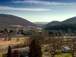
Milesburg, Pennsylvania
| Milesburg, Pennsylvania | |
|---|---|
| Borough | |
 Milesburg | |
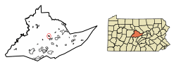 Location of Milesburg in Centre County, Pennsylvania. | |
 Map showing Centre County in Pennsylvania | |
 Milesburg Location of Milesburg in Centre County, Pennsylvania. | |
| Coordinates: 40°56′33″N 77°47′21″W / 40.94250°N 77.78917°WCoordinates: 40°56′33″N 77°47′21″W / 40.94250°N 77.78917°W | |
| Country | United States |
| State | Pennsylvania |
| County | Centre |
| Settled | 1793 |
| Incorporated (borough) | 1843 |
| Government | |
| • Mayor | Brandon Schadle |
| Area[1] | |
| • Total | 0.45 sq mi (1.16 km2) |
| • Land | 0.45 sq mi (1.16 km2) |
| • Water | 0.00 sq mi (0.00 km2) |
| Elevation | 692 ft (211 m) |
| Population (2010) | |
| • Total | 1,123 |
| • Estimate (2016)[2] | 1,080 |
| • Density | 2,416.11/sq mi (933.82/km2) |
| Time zone | Eastern (EST) |
| • Summer (DST) | EDT |
| Zip code | 16853 |
| Area code(s) | 814 |
| FIPS code | 42-49368 |
Milesburg is a borough in Centre County, Pennsylvania. It is part of the State College, Pennsylvania Metropolitan Statistical Area. The population was 1,123 at the 2010 census.
History
Milesburg, as well as nearby Miles Township was named after Col. Samuel Miles,[3] who co-owned the Centre Furnace Iron Works, along with Colonel John Patton and John Dunlop.
Milesburg is on (or near) the site of a former Lenape Indian settlement known as Bald Eagle's Nest.
The Iddings-Baldridge House was added to the National Register of Historic Places in 1977.[4]
Geography
Milesburg is located at 40°56′33″N 77°47′21″W / 40.94250°N 77.78917°W (40.942533, -77.789207).[5]
According to the United States Census Bureau, the borough has a total area of 0.4 square miles (1.0 km2), all of it land.
Demographics
| Historical population | |||
|---|---|---|---|
| Census | Pop. | %± | |
| 1850 | 478 | — | |
| 1860 | 591 | 23.6% | |
| 1870 | 600 | 1.5% | |
| 1880 | 643 | 7.2% | |
| 1890 | 714 | 11.0% | |
| 1900 | 594 | −16.8% | |
| 1910 | 531 | −10.6% | |
| 1920 | 545 | 2.6% | |
| 1930 | 644 | 18.2% | |
| 1940 | 681 | 5.7% | |
| 1950 | 733 | 7.6% | |
| 1960 | 729 | −0.5% | |
| 1970 | 1,196 | 64.1% | |
| 1980 | 1,309 | 9.4% | |
| 1990 | 1,144 | −12.6% | |
| 2000 | 1,187 | 3.8% | |
| 2010 | 1,123 | −5.4% | |
| Est. 2016 | 1,080 | [2] | −3.8% |
| Sources:[6][7][8] | |||
As of the census[7] of 2010, there were 1,123 people, 459 households, and 305 families residing in the borough. The population density was 2,503.4 people per square mile (966.8/km²). There were 489 housing units at an average density of 1,090.1 per square mile (421.0/km²). The racial makeup of the borough was 98.7% White, 0.4% Black or African American, 0.1% Native American, 0.4% Asian, 0.2% other, and 0.2% from other races. Hispanic or Latino of any race were 0.3% of the population.
There were 459 households, out of which 29.8% had children under the age of 18 living with them, 47.3% were married couples living together, 6.2% had a male householder with no wife present, 12.9% had a female householder with no husband present, and 33.6% were non-families. 26.6% of all households were made up of individuals, and 8.5% had someone living alone who was 65 years of age or older. The average household size was 2.45 and the average family size was 2.77.
In the borough the population was spread out, with 19.1% under the age of 18, 8.8% from 18 to 24, 25.3% from 25 to 44, 29.3% from 45 to 64, and 17.5% who were 65 years of age or older. The median age was 42 years. For every 100 females there were 89.1 males. For every 100 females age 18 and over, there were 87.8 males.
The median income for a household in the borough was $45,588, and the median income for a family was $51,597. The per capita income for the borough was $19,310. About 5.0% of families and 7.2% of the population were below the poverty line, including 1.7% of those under age 18 and 3.4% of those age 65 or over.
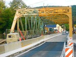 Bridge repairs
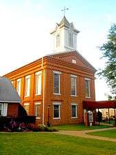 Baptist Church
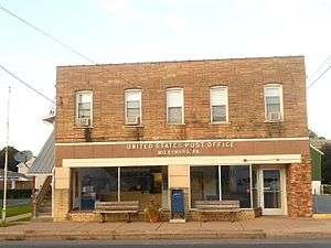 Post office
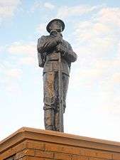 All Wars Memorial
References
- ↑ "2016 U.S. Gazetteer Files". United States Census Bureau. Retrieved Aug 13, 2017.
- 1 2 "Population and Housing Unit Estimates". Retrieved June 9, 2017.
- ↑ Gannett, Henry (1905). The Origin of Certain Place Names in the United States. U.S. Government Printing Office. p. 208.
- ↑ National Park Service (2010-07-09). "National Register Information System". National Register of Historic Places. National Park Service.
- ↑ "US Gazetteer files: 2010, 2000, and 1990". United States Census Bureau. 2011-02-12. Retrieved 2011-04-23.
- ↑ "Census of Population and Housing". U.S. Census Bureau. Retrieved 11 December 2013.
- 1 2 "American FactFinder". United States Census Bureau. Retrieved 2008-01-31.
- ↑ "Incorporated Places and Minor Civil Divisions Datasets: Subcounty Resident Population Estimates: April 1, 2010 to July 1, 2012". Population Estimates. U.S. Census Bureau. Archived from the original on 17 June 2013. Retrieved 11 December 2013.