Jacksonville, Centre County, Pennsylvania
| Jacksonville, Pennsylvania | |
|---|---|
| Census-designated place | |
_Church_along_PA_Route_26.jpg) Emmanuel United Church of Christ | |
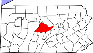 Map showing Centre County in Pennsylvania | |
 Jacksonville Map showing Jacksonville in Centre County | |
| Coordinates: 40°59′32″N 77°37′55″W / 40.99222°N 77.63194°WCoordinates: 40°59′32″N 77°37′55″W / 40.99222°N 77.63194°W | |
| Country | United States |
| State | Pennsylvania |
| County | Centre |
| Township | Marion |
| Area | |
| • Total | 0.14 sq mi (0.37 km2) |
| • Land | 0.14 sq mi (0.37 km2) |
| • Water | 0.0 sq mi (0.0 km2) |
| Elevation | 902 ft (275 m) |
| Population (2010) | |
| • Total | 95 |
| • Density | 668/sq mi (258.1/km2) |
| Time zone | UTC-5 (Eastern (EST)) |
| • Summer (DST) | UTC-4 (EDT) |
| FIPS code | 42-37545 |
| GNIS feature ID | 2584473 |
Jacksonville is an unincorporated community and census-designated place[1] in Marion Township, Centre County, Pennsylvania, United States. As of the 2010 census, the population was 95 residents.[2]
The town is located in the Little Nittany Valley 10 miles (16 km) northeast of Bellefonte, the Centre County seat. Howard Gap in Bald Eagle Mountain is just to the northwest of the town. Pennsylvania Route 26 passes through the gap, leading 2.5 miles (4.0 km) to the borough of Howard. Interstate 80 passes through the Little Nittany Valley just southeast of Jacksonville but with no direct access, the nearest exit being 6 miles (10 km) to the southwest at Interstate 99/U.S. Route 220.
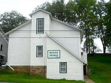 Grange
References
- ↑ "Archived copy". Archived from the original on December 21, 2013. Retrieved February 13, 2016.
- ↑ "Geographic Identifiers: 2010 Census Summary File 1 (G001): Jacksonville CDP, Pennsylvania". U.S. Census Bureau, American Factfinder. Retrieved April 15, 2015.
External links
This article is issued from
Wikipedia.
The text is licensed under Creative Commons - Attribution - Sharealike.
Additional terms may apply for the media files.